TL;DR:
- Digital prospecting uses AI and geospatial data to significantly improve drill success rates.
- It processes large datasets to generate priority maps, guiding targeted and efficient field validation.
- Combining digital tools with traditional fieldwork optimizes mineral exploration, especially in covered terrains.
AI-enabled digital prospecting is achieving drill success rates near 75% in regions like Broken Hill, a figure that makes traditional field-only methods look painfully inefficient by comparison. For prospectors and mining teams working across New South Wales and Victoria, this shift is not a distant trend. It is happening right now, reshaping how targets are chosen, how budgets are spent, and how often drill bits actually hit pay dirt. This guide breaks down what digital prospecting really means, how the workflow operates, where it has delivered real results in your backyard, and how you can start applying it today.
Table of Contents
- What is digital prospecting?
- How does digital prospecting actually work?
- Real-world examples in NSW and Victoria
- Nuances and pitfalls: What to watch for
- How to get started with digital prospecting
- Why digital prospecting will—and won't—replace boots-on-ground
- Accelerate your prospecting with the right digital tools
- Frequently asked questions
Key Takeaways
| Point | Details |
|---|---|
| Faster, smarter targeting | AI-driven digital prospecting focuses your search, finding rich mineral zones more quickly with fewer wasted resources. |
| Integrate, then validate | Digital maps guide where to look, but boots-on-ground sampling is necessary to turn data into discoveries. |
| Leverage Australian data | Free Geoscience Australia and CSIRO datasets can jumpstart your digital prospecting in NSW and Victoria. |
| Avoid common pitfalls | Balance AI models with field expertise, prioritize high-quality data, and always validate before investing heavily. |
What is digital prospecting?
With that dramatic improvement in mind, let's get clear on what digital prospecting actually means in practice.
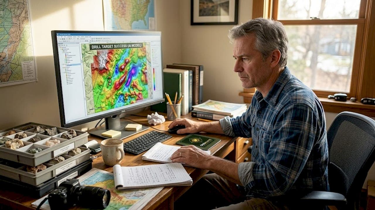
Digital prospecting is the use of GIS, remote sensing, AI and ML for mineral mapping and targeting. It pulls together multiple data streams that traditional field teams could never process manually, then uses machine learning models to rank areas by their likelihood of hosting economic mineralization. The result is a probability map that tells your team where to look before anyone picks up a hammer or drives a drill.
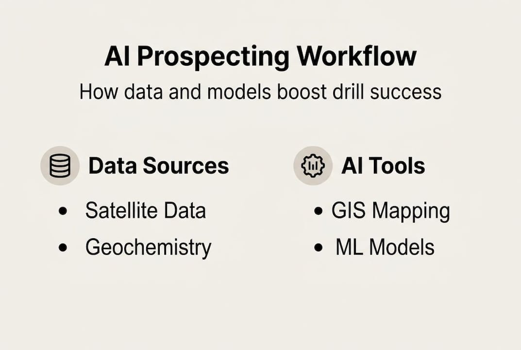
Modern digital prospecting draws on a wide range of data sources:
- Satellite imagery for surface alteration and structural mapping
- LiDAR for high-resolution topographic and structural analysis
- Airborne geophysics including magnetic and gravity surveys
- Geochemical sampling data from soil, rock, and stream sediment
- Historical drill hole databases and legacy geological reports
Digital prospecting can dramatically reduce the amount of fieldwork required while mapping far more ground than a traditional crew could cover in the same timeframe.
For NSW and Victoria, this matters enormously. Both states have vast covered terrains where regolith masks bedrock geology, making surface prospecting unreliable. Digital tools cut through that noise by analyzing subsurface signals that human eyes simply cannot detect in the field.
| Factor | Digital prospecting | Traditional prospecting |
|---|---|---|
| Data volume processed | Millions of data points | Limited by field capacity |
| Targeting accuracy | AI-ranked probability maps | Experience-based judgment |
| Time to first target | Days to weeks | Months |
| Cost per km² mapped | Lower at scale | Higher per unit area |
| Field validation needed | Yes, targeted | Yes, extensive |
You can review prospecting best practices to understand how digital methods slot into a broader exploration strategy, and explore site selection with digital tools for NSW and Victoria-specific guidance.
Pro Tip: Start with free datasets from Mineral Exploration at Geoscience Australia before spending a dollar on commercial data. The publicly available magnetic, gravity, and geochemical layers alone can power a first-pass AI model.
How does digital prospecting actually work?
With a definition in place, it is important to see the actual digital workflow in action.
The process moves through a logical sequence that any team can follow:
- Data acquisition: Download geological maps, airborne geophysics, geochemical surveys, and satellite imagery from Geoscience Australia, CSIRO, and state geological surveys.
- GIS integration: Layer all datasets in a GIS platform, aligning projections and resolving resolution differences between data types.
- Feature engineering: Extract meaningful variables such as magnetic gradients, spectral indices, and proximity to faults or contacts.
- AI modeling: Run ML for mineral prospectivity using algorithms like random forests, convolutional neural networks (CNNs), or ensemble methods.
- Favorability map output: Generate a ranked probability map showing high, medium, and low priority zones.
- Field validation loop: Send teams to top-ranked targets for sampling and verification before committing to drilling.
Data integration from multiple sources is processed via GIS, AI, and ML to produce prospectivity models that guide real exploration decisions.
Here is how the core data types contribute to the model:
| Data type | Role in AI modeling |
|---|---|
| Geochemical anomalies | Identify element pathfinders near mineralization |
| Magnetic surveys | Map iron-bearing alteration and structural controls |
| Gravity data | Detect density contrasts linked to intrusions or sedimentary basins |
| Satellite multispectral | Map surface mineralogy and hydrothermal alteration |
Random forest models are particularly powerful here. They can capture 75% of successful sites within just 3.5% of the total mapped area, which means your field team spends time in the right places instead of wandering across low-priority ground.
For NSW and Victoria teams, the practical stack looks like this: Geoscience Australia for base layers, CSIRO research outputs for model benchmarks, open-source Python libraries for ML, and platforms like DigMate for integrated AI-driven targeting. You can learn more about how to boost efficiency with AI and geospatial tools and why geodata quality matters for every model you build.
Real-world examples in NSW and Victoria
Now let's see these digital tools in action with real results from the field.
CNNs delineated mineral alteration zones north of Broken Hill using satellite remote sensing data, mapping argillic, iron oxide, and propylitic zones with precision that traditional mapping could not match. That is not a lab experiment. That is a working example from your region.
Key projects and outcomes where digital tools delivered:
- Broken Hill corridor: CNN-based alteration mapping identified structural targets previously missed by surface mapping teams.
- Victorian goldfields: Satellite remote sensing increased identified prospects by 60% compared to conventional methods in the same tenure.
- Covered terrain in central NSW: Geophysical inversion combined with geochemical modeling pinpointed buried intrusion-related gold targets.
- Critical minerals screening in Victoria: AI models ranked lithium and cobalt prospectivity across large areas in weeks rather than years.
The numbers behind these results are hard to ignore. Digital-led programs are achieving drill success near 75% with a return on investment approaching 1:10 for gold discovery programs, compared to the single-digit success rates that plague traditional random drilling campaigns.
The lesson from early digital campaigns in both states is consistent: the first round of digital targeting often reveals clusters of high-priority zones that field teams had never visited. But the teams that got the best outcomes were those who validated digital leads quickly with soil sampling and rock chip surveys before committing to expensive drilling programs.
You can dig deeper into exploration tips for NSW and Victoria, review top AI prospecting tools available today, and understand how geology drives gold finding across both states.
Pro Tip: Always validate digital leads with on-the-ground sampling before major drilling. A single soil traverse across a high-ranked AI target costs almost nothing compared to a wasted drill hole.
Nuances and pitfalls: What to watch for
While the benefits are clear, pitfalls and nuances can trip up even experienced teams.
The most common mistake is treating a digital prospectivity map as a finished answer rather than a starting hypothesis. The map is only as good as the data that fed it.
Top challenges teams face in NSW and Victoria:
- Data scarcity in remote areas: Many parts of both states have sparse historical data, which limits model training quality.
- Imbalanced datasets: Known mineral deposits are rare compared to non-deposit locations, which can bias models toward false negatives.
- Conservative organizational culture: Many established teams resist changing workflows that have worked for decades.
- Edge case adaptation: Models trained on one deposit type can perform poorly when applied to a different geological setting.
- Fragmented data ownership: State and federal datasets do not always align in format, resolution, or coverage.
Digital prospecting cuts fieldwork and optimizes drilling, but mining is a conservative industry and data is often fragmented. The teams that succeed treat digital outputs as a hypothesis to test, not a verdict to act on blindly.
Data scarcity and imbalanced datasets require solutions like SMOTE for synthetic sample balancing, ensemble ML methods that reduce single-model bias, and careful optimization of negative training samples. Field validation remains non-negotiable regardless of model confidence scores.
The role of high-quality geodata cannot be overstated here. Garbage in means garbage out, and no amount of sophisticated modeling fixes a fundamentally poor input dataset.
Digital adoption in mining is accelerating, but the teams pulling ahead are those combining rigorous data curation with human geological expertise, not those simply running models on whatever data they can find.
Pro Tip: Junior companies in NSW and Victoria are leading digital adoption right now. Do not wait for the majors to set the standard. The competitive advantage belongs to teams willing to move first.
How to get started with digital prospecting
Having covered what works and what does not, here is how you can put digital prospecting into practice starting today.
Follow this sequence to get your first digital prospecting model running:
- Download base data: Access magnetic, gravity, and geochemical datasets from Geoscience Australia and CSIRO for your target area in NSW or Victoria.
- Choose your GIS platform: QGIS is free and capable. ArcGIS Pro is industry standard. Either works for first-pass integration.
- Select your ML approach: Start with random forests using Python's scikit-learn library. They are interpretable, robust, and well-documented.
- Run a trial model: Use known deposits in your region as positive training samples and generate a first favorability map.
- Plan a validation traverse: Send a field team to the top 5 to 10 ranked targets for soil sampling or rock chip collection.
- Iterate: Feed validation results back into the model to improve the next round of predictions.
Key platforms and resources to build your digital stack:
- Geoscience Australia: Free national geophysical and geochemical datasets
- CSIRO: Research benchmarks and published prospectivity models
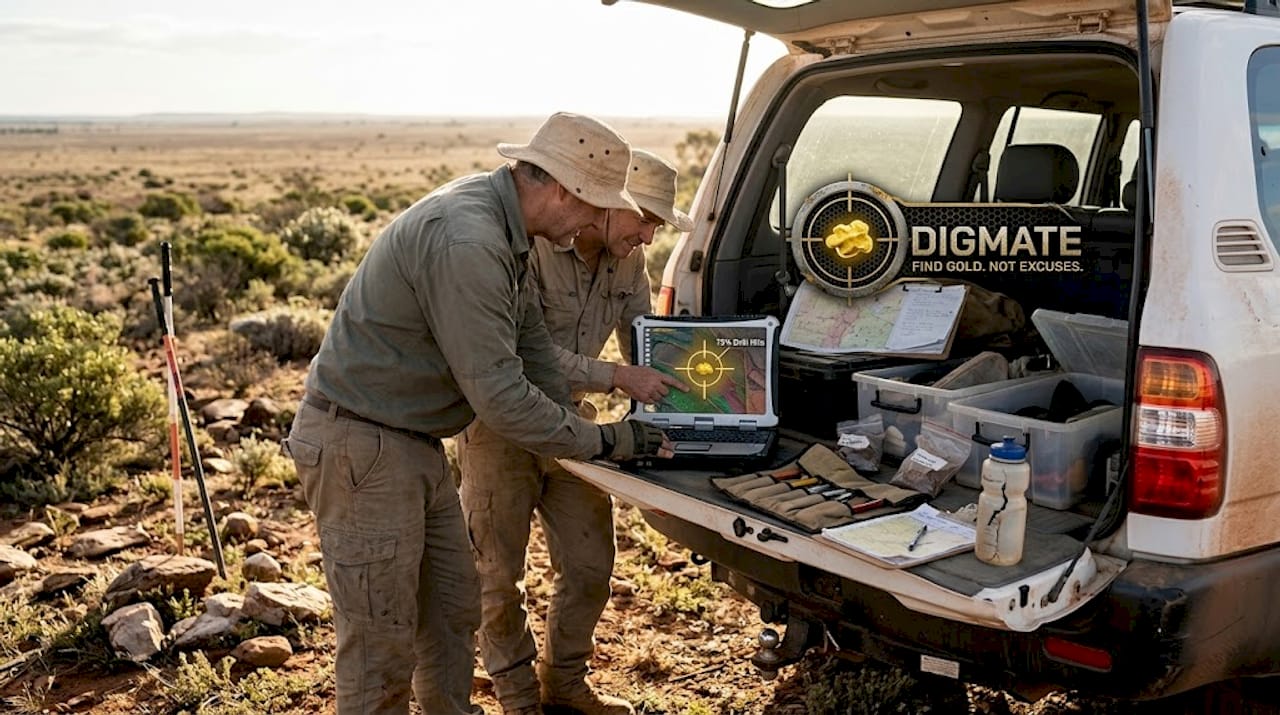
- DigMate: Australian-focused AI prospecting, mapping, and ground-scan tools
- Open-source ML tools: Python, scikit-learn, TensorFlow for custom modeling
- State geological surveys: NSW and Victoria-specific datasets and reports
The most important thing is to assemble a multidisciplinary team. A geologist who understands the deposit model, a data scientist who can build and validate the ML pipeline, and a field geologist who can interpret results on the ground are all essential. No single person covers all three roles well.
Review exploration best practices to make sure your digital workflow aligns with proven field strategies from the start.
Pro Tip: Spend your first budget on covered terrain that traditional methods have ignored. Free satellite and geophysics data often reveal high-priority targets in areas that look blank on a conventional geological map.
Why digital prospecting will—and won't—replace boots-on-ground
Here is the perspective that most digital prospecting articles miss entirely.
Chasing a purely digital solution without deep field expertise is how teams miss the most significant discoveries. AI maps tell you where to look. They do not tell you what you are actually looking at when you get there. The geologist standing on the outcrop, reading the alteration, smelling the sulfides, and recognizing the structural context still makes the call that matters.
The most successful teams in NSW and Victoria right now are not the ones with the most sophisticated models. They are the ones using AI outputs as targeting tools while spending their valuable field time only on the highest-ranked zones. That combination multiplies the value of every dollar and every day in the field.
The industry's conservative mindset is actually an opportunity. While majors debate digital transformation strategies, junior teams using advanced prospecting strategies are quietly banking discoveries in ground that was written off years ago. Digital sophistication does not replace fieldwork. It makes fieldwork dramatically more productive by ensuring you are always standing in the right place.
Accelerate your prospecting with the right digital tools
Modern mineral targeting demands tools that bring AI, geospatial data, and practical field guidance together in one place. Scattered spreadsheets and outdated paper maps simply cannot compete with integrated digital workflows when you are trying to find economic mineralization in NSW or Victoria.
DigMate is built specifically for Australian prospectors and mining professionals. The platform combines AI-powered prospecting features with Australian geospatial data, mineral detection tools, and location mapping designed for the covered terrains of NSW and Victoria. Whether you are running your first digital model or refining an existing program, access the free gold prospecting map to see how AI-driven targeting looks in your region before committing to a full workflow.
Frequently asked questions
What makes digital prospecting more effective than traditional methods?
Digital prospecting integrates diverse datasets and uses AI to focus efforts, raising drill success rates to around 75% and finding more viable targets faster than field-only approaches.
Is digital prospecting suitable for small teams or only majors?
It is especially accessible for junior teams in NSW and Victoria, and juniors are leading adoption of digital prospecting over larger, slower-moving majors right now.
Do I need to replace fieldwork completely if I use digital prospecting?
Traditional fieldwork remains essential for confirming digital targets, reducing risk, and avoiding the costly mistakes that come from acting on unvalidated model outputs.
What data do I need to start digital prospecting in Australia?
Start with free Geoscience Australia and CSIRO datasets, then add high-resolution satellite imagery or local geochemical data to sharpen your targeting in specific areas.