TL;DR:
- AI-powered models analyze multiple data types simultaneously to improve gold prospectivity mapping.
- Proper training data quality and expert interpretation are crucial for effective AI-guided exploration.
- These tools enhance traditional methods, reducing uncertainty and identifying overlooked mineralization zones.
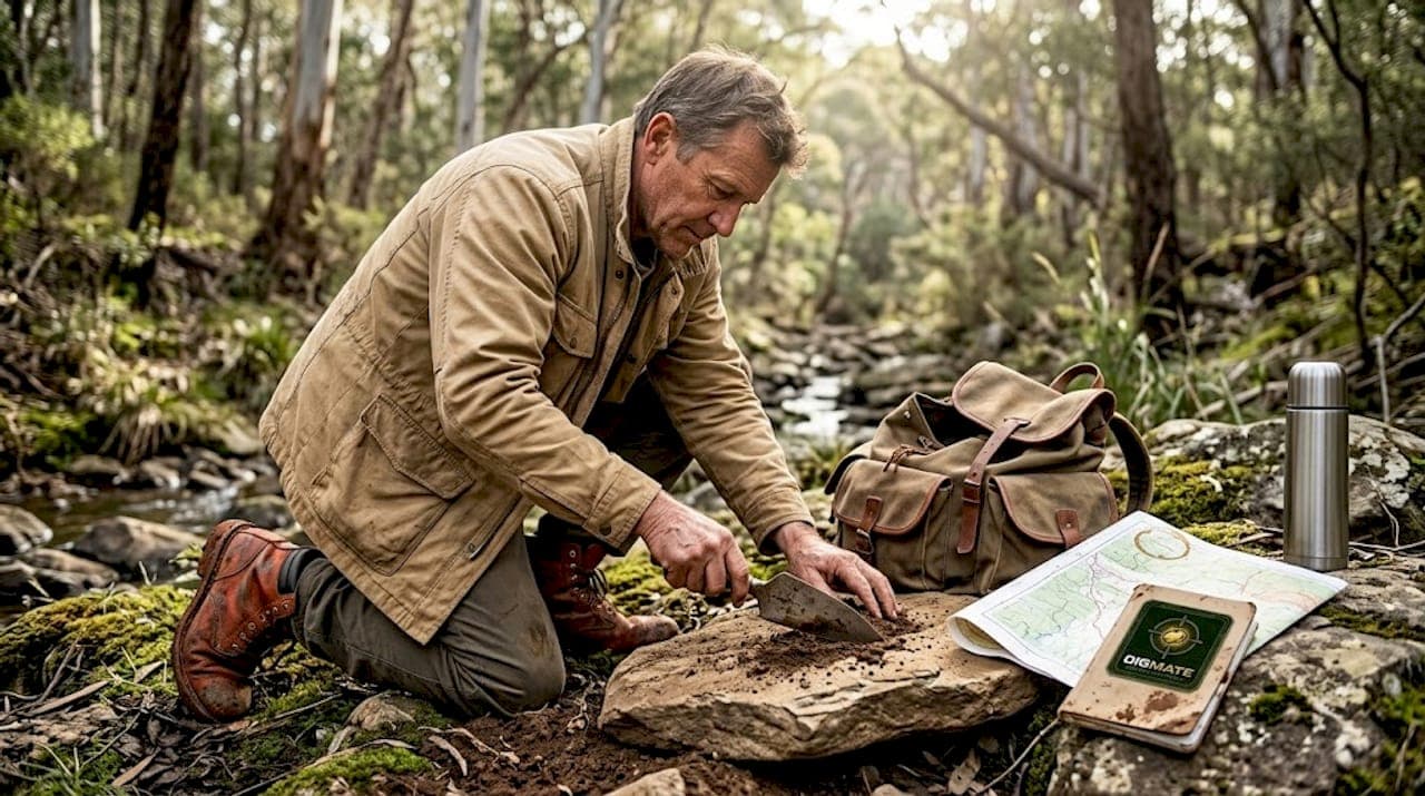
Most prospecting teams have walked away from ground that held real gold, not because they lacked experience, but because the data they were working with was too messy, too incomplete, or too hard to synthesize manually. That gap between effort and outcome is one of the most frustrating realities in gold exploration across New South Wales and Victoria. The good news is that AI-powered prospectivity modeling is changing the math. This guide breaks down how these tools work, what they're actually good at, where they fall short, and how you can use them to make sharper, more confident decisions in the field.
Table of Contents
- Why traditional methods aren't enough
- How AI enhances gold detection: The fundamentals
- Solving real-world challenges with AI: What prospectors need to know
- Case studies and real-world application: NSW and Victoria success stories
- A smarter path forward: What most prospectors miss about AI
- Discover next-generation gold detection with DigMate
- Frequently asked questions
Key Takeaways
| Point | Details |
|---|---|
| AI reduces exploration risk | By combining diverse geological data, AI helps you target gold deposits more confidently and efficiently. |
| Improved accuracy with AI | Benchmarked AI models outperform traditional methods, shown by high ROC/AUC scores in field studies. |
| Practical results for prospectors | New AI tools are already helping NSW and Victoria teams zero in on high-potential gold zones. |
| Balanced human-AI collaboration | AI decision support works best when paired with local knowledge and expert validation. |
Why traditional methods aren't enough
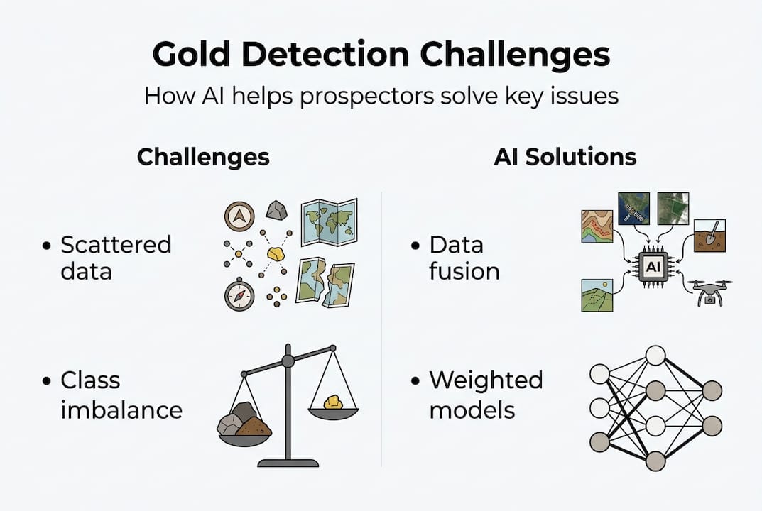
Gold doesn't announce itself. It hides in structural intersections, sits beneath heavy overburden, and leaves faint geochemical whispers that are easy to miss if you're only looking at one data type at a time. That's the core problem with conventional exploration: it relies on interpreting several independent lines of evidence, and doing that manually at scale is where things break down.
Think about a typical project in Victoria's goldfields. You might have soil geochemistry, historical drilling logs, aeromagnetic surveys, and regional geology maps, all in different formats, all collected at different times, all interpreted by different people. Pulling that together into a coherent targeting decision is genuinely difficult. Multi-source evidence increases complexity and uncertainty in mineral targeting, and no amount of experience fully cancels that out.
Here are the most common ways traditional methods let prospectors down:
- Overburden blindness: Surface sampling often fails to represent what's happening at depth, especially in weathered or alluvial terrain.
- Data siloing: Geology, geochemistry, and geophysics are analyzed separately, missing cross-signal patterns that only show up when layers are combined.
- Manual bias: Experienced interpreters unconsciously favor certain target types or zones they've drilled before, sometimes overlooking genuinely novel settings.
- Drilled-out fatigue: Teams tend to discount areas with historical drilling, even when new data would reveal previously missed zones.
"The challenge isn't collecting data. It's making sense of all of it at once, especially when sources conflict or gaps exist." This is exactly where algorithmic approaches earn their keep.
Understanding how geology and gold finding interact is foundational, but even that knowledge has limits without a system that can process every variable simultaneously. For smarter prospecting tips that actually cut through the noise, integrating digital tools into your workflow is no longer optional.
How AI enhances gold detection: The fundamentals
At its core, AI-based gold detection is about building a predictive model that asks: given everything we know about this piece of ground, how likely is it to host economic mineralization? The answer comes from training algorithms on known deposit locations and teaching them to recognize the patterns that distinguish mineralized ground from barren ground.

The most commonly benchmarked models right now are Random Forest, Support Vector Machines (SVM), and XGBoost. Each handles data differently, but all three are designed to find non-linear relationships across many variables at once. That's the key advantage. Where a human analyst might track five or six criteria, these models process dozens simultaneously and weight them by predictive importance.
Benchmarked AI models achieve AUCs of 0.91 to 0.93 in real gold mapping tasks, which means they correctly distinguish prospective from non-prospective ground more than nine times out of ten. That's a meaningful performance level for exploration decisions.
Here's how the process typically unfolds:
- Data assembly: Geological maps, geochemical surveys, geophysical grids, and remote sensing layers are standardized into a common spatial framework.
- Training sample creation: Known deposit locations become positive examples; carefully selected barren ground becomes negative examples.
- Model training: Algorithms learn the multivariate fingerprint of mineralization from those examples.
- Prospectivity map generation: The trained model predicts mineralization likelihood across the entire project area, producing a ranked spatial output.
- Validation: Model performance is tested against data the algorithm never saw during training.
| AI model | Strength | Best use case |
|---|---|---|
| Random Forest | Handles missing data well | Regional-scale mapping |
| XGBoost | High accuracy, fast training | Large, complex datasets |
| SVM | Strong on small datasets | Focused district studies |
Pro Tip: Don't fixate on a single model. Running an ensemble (combining outputs from multiple models) consistently beats any one algorithm in real exploration contexts. It reduces overfit and gives you a more stable prospectivity signal.
Exploring AI prospecting tools designed for the Australian goldfields gives you a head start on understanding which platforms already have these workflows built in. For the spatial side, AI and geospatial efficiency is where the real productivity gains show up.
Solving real-world challenges with AI: What prospectors need to know
Knowing that AI works in theory is one thing. Understanding what actually trips it up in practice is what separates prospectors who get value from these tools from those who get burned.
The biggest issue is training data quality. Supervised AI models learn from examples, which means the quality of your positive and negative samples directly controls the quality of your predictions. If your deposit locations are incomplete or your negative samples are poorly chosen, the model learns the wrong lesson.
Here's where the real-world complications pile up:
- Class imbalance: Mineral deposits are rare by definition. In any project area, there are vastly more barren grid cells than deposit cells, which can push the model to predict "barren" by default.
- Negative sample bias: If you pick your "no deposit" examples too close to known deposits or too far away in geologically irrelevant terrain, the model won't generalize well.
- Data scarcity: In under-explored parts of NSW and Victoria, you might have only a handful of known occurrences to train on.
Proper data handling, including negative class creation and weighting, is critical for reliable gold mapping, and skipping these steps is one of the fastest ways to generate a beautiful-looking map that points you in the wrong direction.
| Challenge | Risk if ignored | AI solution |
|---|---|---|
| Class imbalance | Model defaults to predicting barren | Oversampling or cost-sensitive weighting |
| Poor negative samples | Overfitting to irrelevant patterns | Strategic buffer zones around deposits |
| Small training sets | High variance, low confidence | Ensemble models and cross-validation |
Pro Tip: Weight your known deposit locations by estimated resource size or grade. A multi-million-ounce deposit in Victoria carries more modeling signal than a small shallow prospect, and your training data should reflect that hierarchy.
The strongest outcomes always come from pairing AI outputs with expert drilling knowledge. Following exploration best practices built around this hybrid approach is what actually moves exploration programs forward.
Case studies and real-world application: NSW and Victoria success stories
The question every serious prospector asks is simple: does this actually work in the ground, not just in a research paper? The answer is yes, with caveats around how you set up and validate the process.
Modern AI exploration programs benchmark performance using a standardized set of metrics. Here's how validation typically works in practice:
- ROC/AUC scoring: The model is evaluated on how well it ranks prospective versus barren cells across the full dataset.
- Prediction-area plots: These show what fraction of known deposits fall within the top-ranked fraction of the project area, a critical reality check.
- Held-out district validation: A subset of known deposits is withheld from training entirely. If the model finds them anyway, confidence in its real-world generalizability jumps significantly.
- Geological consistency review: The output map is checked by a geologist to confirm that high-ranked zones make physical sense, not just statistical sense.
"The measurement standards established by AI prospectivity programs in Northern New Brunswick, including ROC/AUC, held-out validation, and geological consistency checks, are now the benchmark for credible exploration programs worldwide."
For NSW and Victoria specifically, the richness of historical data is a genuine advantage. Decades of drilling records, geochemical databases, and geological mapping give AI models more signal to work with than most global jurisdictions. Teams that have applied these frameworks to Victorian lode gold systems and NSW intrusion-related gold deposits consistently report that high-ranked zones correlate with geologically meaningful features, not random noise.
Critically, AI supports skilled prospectors rather than replacing them. The algorithm finds the patterns; the prospector interprets them in the context of local structural knowledge, historical mining, and practical access. Understanding the importance of geodata in this workflow is what keeps exploration programs grounded in reality.
A smarter path forward: What most prospectors miss about AI
Here's the view we've formed after working through what AI genuinely delivers in goldfield contexts: the biggest mistake prospectors make is treating these tools as discovery machines rather than decision-support tools. The promise isn't that AI finds gold for you. The promise is that it sharply reduces the uncertainty you're operating under when you decide where to spend your next dollar.
Metrics like AUC matter, but they're only half the story. Model explainability, meaning outputs that make geological sense and can be defended to a team or investor, is what actually drives adoption. A black-box map that can't be explained is worse than useless in a boardroom or on a field trip.
The prospectors seeing real results are the ones who treat transformative prospecting tools as a layer on top of their own knowledge, not a replacement for it. Local structural intuition plus algorithmic signal is a genuinely powerful combination. Demand transparency from any AI system you use. If you can't understand why a zone ranked high, you can't trust it.
Discover next-generation gold detection with DigMate
Ready to turn these insights into results in the field? DigMate is built specifically for Australian goldfields, integrating AI-powered mapping, geospatial analysis, and prospectivity tools designed for how prospectors in NSW and Victoria actually work.
Explore the full DigMate features suite to see how AI-driven targeting maps can sharpen your next campaign. The ground scan tool puts advanced detection capability directly in your hands, and if you want to see the platform in action before committing, start with the free gold prospecting map and see exactly what the AI is flagging in your target area.
Frequently asked questions
How does AI improve gold detection accuracy compared to traditional methods?
AI combines multiple data sources into predictive models that consistently outperform traditional single-source prospecting and reduce targeting uncertainty. The multivariate approach catches patterns that manual interpretation routinely misses.
What types of data does AI use for gold prospectivity mapping?
AI uses geological, geochemical, geophysical, and remote sensing data to build robust prospectivity maps. Combining these layers is what gives the models their predictive edge over any single data source alone.
Is AI relevant for small-scale prospectors in NSW and Victoria?
Yes. Modern AI tools and apps benefit both large and small operations by revealing overlooked opportunities and improving target accuracy, even when your dataset is limited.
How is AI performance for gold detection measured?
Performance is measured using ROC curves and AUC statistics, combined with held-out district validation to confirm the model generalizes beyond its training data.