TL;DR:
- Understanding regional geology and structural features is crucial for consistent gold discovery in Australia.
- AI tools enhance prospecting by quickly analyzing datasets and identifying high-potential targets.
- Combining geological expertise with advanced technology increases success rates in uncovering hidden gold deposits.
Gold discovery in NSW and Victoria has never been about luck. The prospectors who consistently find gold are the ones who understand what controls its formation, and increasingly, they're pairing that knowledge with AI-driven tools. Geology plays a central role in gold finding through identifying orogenic gold deposits dominant across both states. These two regions sit within some of the world's most productive gold belts, and beneath the familiar landscapes lie billions of dollars in resources that conventional luck-based searching will never uncover. The real edge belongs to those who read the rocks.
Table of Contents
- Why geology is the foundation of gold discovery in Australia
- Key geological indicators and mapping techniques for gold
- Nuances and advanced structural clues prospectors must know
- How AI is revolutionizing gold exploration with geology
- Why a unified approach beats 'either-or' thinking in gold exploration
- Next steps: Apply geological expertise with innovative technology
- Frequently asked questions
Key Takeaways
| Point | Details |
|---|---|
| Orogenic geology is key | Gold deposits in NSW and Victoria mostly form in orogenic belts—understanding these rocks is the foundation for real discovery. |
| Advanced mapping finds more gold | Small faults, intersection points, and deep geochemical zonation lead to high-grade finds often missed by basic surveys. |
| AI boosts prospecting precision | Modern AI tools work alongside geologic data to rapidly identify promising targets, accelerating the path from plan to payoff. |
| Unified strategies win | Combining geological expertise with AI and best practices yields the best results for prospectors and professionals alike. |
Why geology is the foundation of gold discovery in Australia
Understanding what actually controls where gold occurs is the first step toward finding it consistently. In NSW and Victoria, the dominant deposit style is orogenic gold, formed when ancient tectonic events drove hot, metal-rich fluids through deep crustal fractures. These fluids deposited gold along structural pathways in specific host rocks, often at depths that later erosion has exposed at the surface or brought within reach of modern drilling.
Orogenic gold accounts for 30% of global production, and Victoria alone has produced over 80 million ounces historically, with an estimated 75 million ounces still undiscovered. That figure isn't speculation. It's based on rigorous simulation modeling by state geological surveys. NSW tells a similar story, with major goldfields at Kalgoorlie-style belts and greenstone terranes hosting world-class deposits like Tomingley and Tibooburra.
"The scale of undiscovered gold in Victoria alone rivals entire national gold reserves of smaller producing countries. The geology is there. The question is whether you have the tools to read it."
Here's a quick comparison of the two states' gold geology fundamentals:
| Feature | Victoria | New South Wales |
|---|---|---|
| Dominant deposit type | Orogenic (lode and alluvial) | Orogenic, intrusion-related |
| Key goldfields | Bendigo, Ballarat, Fosterville | Tomingley, Tibooburra, Lachlan |
| Historical production | 80+ million ounces | 50+ million ounces |
| Estimated undiscovered resource | ~75 million ounces | Significant, ongoing assessment |
| Primary host rocks | Turbidite sediments, greenstones | Greenstones, metasediments |
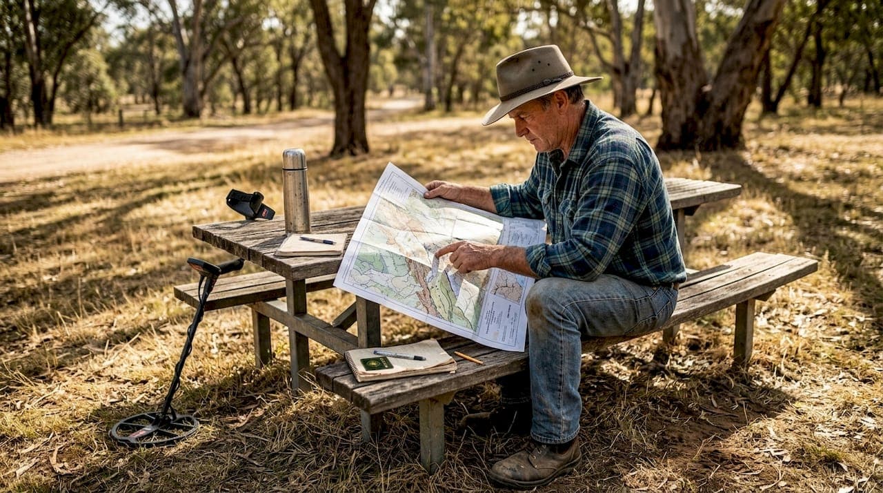
For prospectors, understanding this regional picture means you're not just wandering a paddock with a detector. You're working within a proven geological framework. Reviewing gold prospecting best practices for both states helps you align your fieldwork with the structural trends that actually host gold. Pairing that with an understanding of alluvial gold detection methods gives you a two-pronged approach covering both primary and secondary deposits.
Key geological indicators and mapping techniques for gold
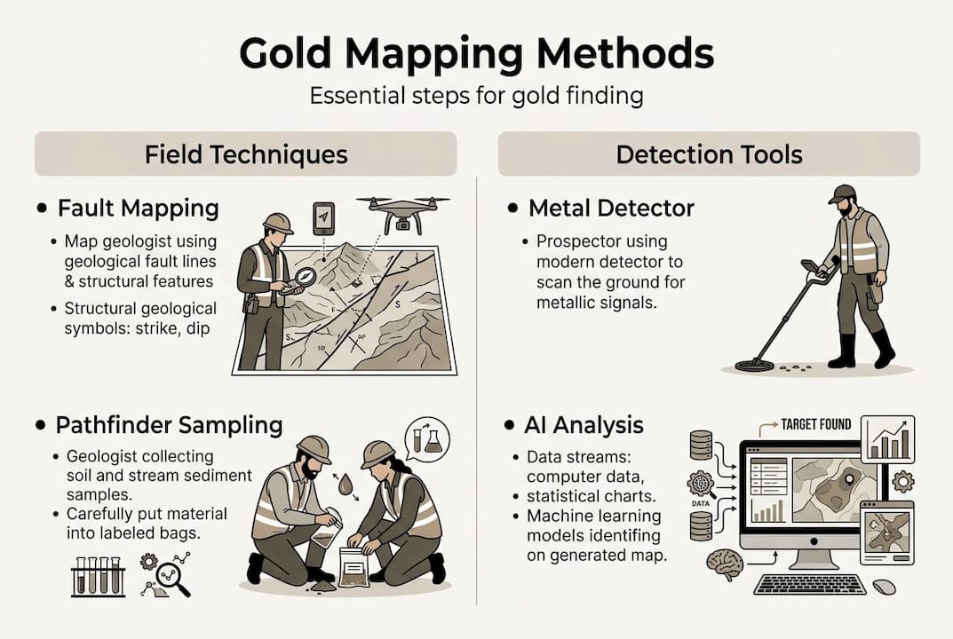
Once you understand why regional geology sets the stage, the next step is pinpointing actual gold zones using proven field and lab techniques. Gold doesn't distribute randomly within a geological terrane. It concentrates at specific structural and chemical traps, and knowing how to recognize those traps separates productive prospectors from frustrated ones.
Structural mapping of faults, shear zones, and geochemical pathfinders are the essential methods for locating gold in both states. Faults and shear zones act as conduits for gold-bearing fluids. Fold hinges, particularly in the Bendigo Zone turbidites, create saddle reef structures where gold accumulates in pressure shadows. Fault intersections are especially productive because they create dilational openings where fluid flow converges.
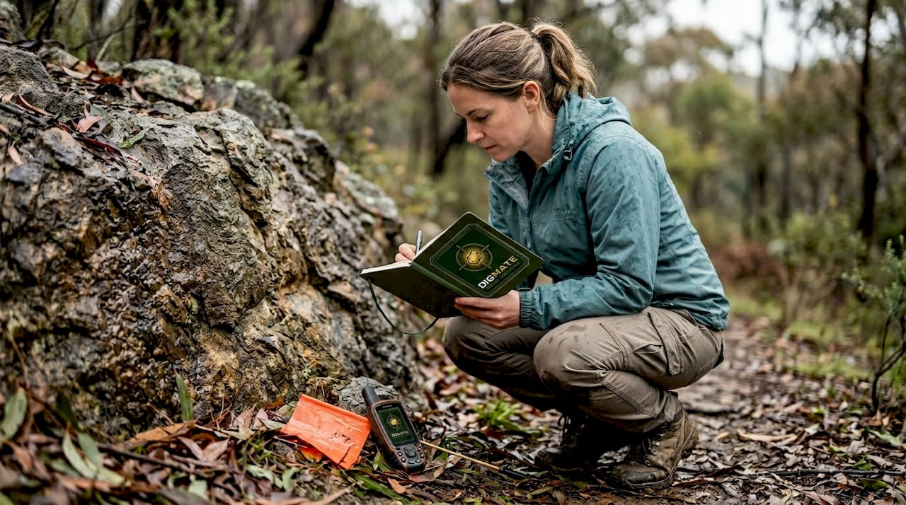
Geochemical pathfinder elements are equally critical. Arsenic (As) and antimony (Sb) consistently appear in elevated concentrations around orogenic gold deposits. They're detectable through soil sampling and stream sediment surveys long before you see visible gold. Carbonaceous host rocks, particularly black slates, are another strong indicator because organic carbon in these rocks chemically strips gold from solution.
Key geological indicators to map in the field:
- Fault and shear zone orientations relative to regional stress fields
- Fold hinge lines and axial plane traces
- Silica flooding, quartz veining, and carbonate alteration halos
- Elevated As and Sb in soil geochemistry
- Greenstone belts and metasedimentary contacts
- Carbonaceous or graphitic horizons in sedimentary sequences
Real production successes reinforce this framework. Fosterville in Victoria became one of the world's highest-grade gold mines by systematically mapping structural controls. Bendigo's historic production came from saddle reef targets in folded turbidites. Tomingley in NSW was discovered through systematic geochemical surveys that flagged pathfinder anomalies years before drilling confirmed economic gold.
| Method | What it detects | Best application |
|---|---|---|
| Structural mapping | Fault/shear geometry | Regional to prospect scale |
| Soil geochemistry | As, Sb, Au anomalies | Targeting beneath cover |
| Rock chip sampling | Alteration, visible gold | Outcrop confirmation |
| Stream sediment survey | Catchment-scale anomalies | Early-stage exploration |
Pro Tip: When you're in the field, don't just look for quartz veins. Look for the alteration halo around them. Silica, carbonate, and sericite alteration extending meters from the vein contact is often a better indicator of a productive system than the vein itself.
For hands-on guidance on choosing the right detection equipment to complement your geological mapping, check out the best metal detector for gold prospecting in Australia. Combining field equipment with solid NSW and Victoria gold tips gives you a complete toolkit.
Nuances and advanced structural clues prospectors must know
Basic models get you into the right region. Elite discoveries depend on understanding nuances the average prospector misses entirely. Most people focus on the big, obvious faults shown on regional maps. The real gold is often somewhere else entirely.
Second- and third-order structures, dilational jogs, and depth-related trace element variation signal high potential that major faults often don't. Here's why: major faults tend to be well-sealed by later mineralization or cementation. Smaller splays and subsidiary faults remain more permeable and create the pressure drops that precipitate gold from hydrothermal fluids. This is a counterintuitive but well-documented phenomenon in Victorian goldfields.
"The richest shoots at Fosterville and Bendigo weren't sitting on the main fault plane. They were in the dilational jogs, the step-overs, and the fold-fault intersections that most prospectors walk right past."
Advanced structural targets to prioritize:
- Dilational jogs: step-overs in fault traces where extension creates open space
- Saddle reefs: anticlinal crests in folded sequences, classic Bendigo targets
- Fold-fault intersections: where axial planes cross fault planes
- Lithological contacts: especially greenstone-sediment boundaries
- Carbonaceous slates overlying quartz reefs: gold concentration during alluvial transfer
The Fosterville depth zonation model is particularly instructive. At shallow levels, antimony dominates the geochemical signature. At depth, arsenic becomes the dominant pathfinder. Understanding this vertical zoning tells you whether you're looking at a near-surface expression or a deeper, potentially higher-grade system. It also helps you interpret drill results and soil surveys with much greater precision.
For alluvial prospectors, carbonaceous slates deserve special attention. When weathering breaks down primary reefs, gold migrates into alluvial systems. Carbonaceous horizons in the bedrock channel act as natural gold traps, concentrating nuggets at specific bedrock irregularities. Knowing where these features occur in your target area dramatically improves your hit rate.
Pro Tip: Before you head out to gold near Albury-Wodonga or any regional target, pull the 1:100,000 geological map for the area and mark all second and third-order fault traces. These are your primary search corridors, not the thick red lines showing major structures.
For field technique guidance, metal detecting for gold in structurally complex terrain requires specific approaches that match your geological understanding.
How AI is revolutionizing gold exploration with geology
The smartest explorers today combine geological expertise with breakthrough technologies for a genuine competitive edge. AI doesn't replace geological knowledge. It amplifies it by processing datasets at a scale no human team can match.
Here's what AI actually does in modern gold exploration:
- Ingests legacy geochemical, geophysical, and drilling datasets from state surveys
- Identifies spatial correlations between known deposits and geological variables
- Generates prospectivity scores across entire regions in hours, not years
- Highlights anomalous zones that human review would likely miss
- Vectors exploration teams toward the most statistically favorable targets
Platforms like VRIFY DORA and Earth AI use machine learning to generate prospectivity scores and vectoring from geological data. These aren't black-box predictions. The best platforms allow geologists to interrogate the model, understand which variables are driving the scores, and apply professional judgment to refine targets.
AI targets have been validated by discovery drill holes in NSW and Victoria, accelerating high-grade finds that traditional methods had overlooked. Earth AI's work in NSW is a concrete example: machine learning models identified structural targets in covered terrain that geophysical surveys alone hadn't flagged, and subsequent drilling confirmed economic mineralization.
| AI capability | Traditional method equivalent | AI advantage |
|---|---|---|
| Prospectivity modeling | Manual data compilation | 100x faster, broader dataset |
| Anomaly detection | Expert visual review | Consistent, no fatigue bias |
| Target ranking | Geologist prioritization | Objective, data-driven scoring |
| Cover penetration | Surface mapping only | Integrates subsurface data |
Pro Tip: Don't treat AI prospectivity maps as a treasure map. Treat them as a first-pass filter. Use the output to narrow your search area, then apply your structural and geochemical knowledge to rank targets within the flagged zones.
For a broader view of available tools, the top AI prospecting tools article covers platforms suited to different scales of exploration. You can also explore AI geospatial prospecting tools for workflows that integrate mapping with detection. The DigMate ground scan feature brings this capability directly to field-level prospecting.
Why a unified approach beats 'either-or' thinking in gold exploration
Here's an uncomfortable truth: we've seen both camps fail. Pure data scientists who've never held a rock hammer generate beautiful prospectivity maps that ignore basic structural geology, leading exploration teams into geologically impossible targets. And traditional geologists who dismiss AI as hype miss high-grade zones hidden under cover that no amount of surface mapping would ever reveal.
The orogenic model unifies gold systems, but some experts argue this broad classification can blur important distinctions between deposit styles. AI should be seen as a tool that supports, not replaces, geological insight. The seasoned professionals in NSW and Victoria who consistently make discoveries are the ones who use AI outputs as hypotheses, then go test them with boots-on-ground geology.
Common advice tells prospectors to either "trust the technology" or "trust your instincts." Both are incomplete. The real skill is knowing when the AI is pointing at something genuinely anomalous and when it's responding to a data artifact. That judgment only comes from geological training and field experience. Explore AI prospecting tool insights to understand how to evaluate these platforms critically rather than accepting their outputs at face value. Skepticism, paired with curiosity, is what drives genuine discovery.
Next steps: Apply geological expertise with innovative technology
You now have the geological framework and the technological context to approach gold exploration in NSW and Victoria with real precision. The next step is putting it into practice with tools built specifically for this landscape.
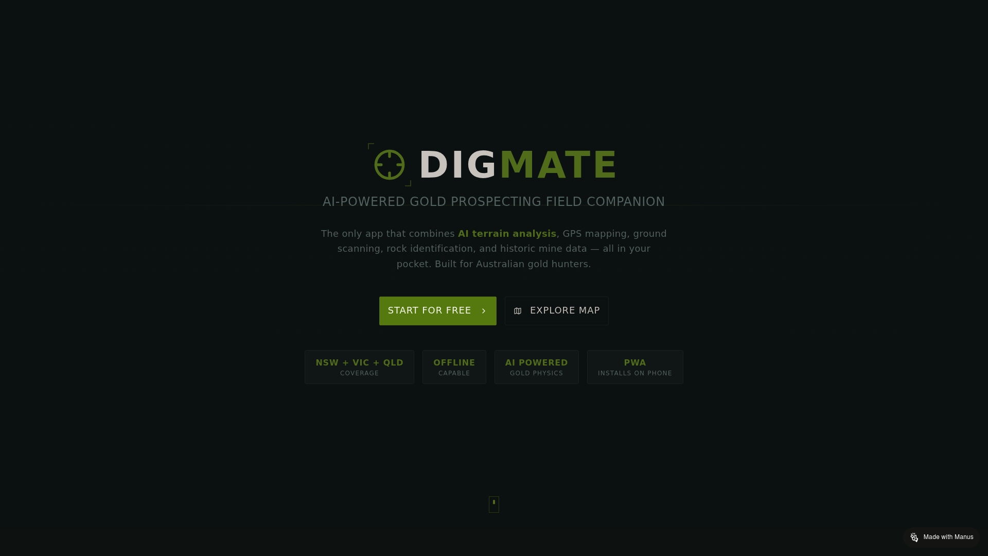
DigMate is designed for exactly this purpose. The DigMate ground scan tool brings AI-powered subsurface analysis to your fieldwork, helping you identify targets that align with the structural and geochemical indicators covered in this guide. Start by downloading the free NSW/Victoria gold map to overlay your geological knowledge with real prospectivity data for both states. Whether you're a weekend prospector or a professional explorer, DigMate gives you the data infrastructure to work smarter in the field, not just harder.
Frequently asked questions
What are the main geological signs of gold in NSW and Victoria?
Structural mapping of faults, shear zones, and geochemical indicators is essential for gold finding in both states. Key signs include elevated arsenic and antimony in soils, quartz veining in greenstone or metasedimentary host rocks, and proximity to fault intersections.
How does AI improve gold prospecting compared to traditional methods?
Platforms like VRIFY DORA and Earth AI use machine learning to generate prospectivity scores from large geological datasets far faster than manual analysis. However, expert geological interpretation remains essential to validate and act on AI outputs effectively.
Are small faults really more important than large ones for gold in Victoria?
Yes. Second- and third-order faults and intersections are high-potential gold sites because they remain more permeable and create the dilational openings where gold precipitates from hydrothermal fluids.
How much undiscovered gold may remain in Victoria?
Victoria has an estimated 75 Moz of gold yet to be discovered, based on simulation modeling by state geological surveys, making it one of the most prospective underexplored regions in the world.