TL;DR:
- Proper permits and legal compliance are essential to access mineral regions in NSW and Victoria.
- Combining geological maps, historic records, and local knowledge significantly improves prospecting success.
- AI-driven tools and resource sharing enhance efficiency, reducing costs and increasing discovery chances for small-scale prospectors.
Mineral exploration in New South Wales and Victoria is genuinely exciting, but it can also feel like navigating a maze. Strict permit requirements, competing data sources, and an overwhelming number of methods make it hard to know where to start or what to trust. Whether you're an individual fossicker or running a small exploration operation, you need a strategy that's practical, legally sound, and built for today's landscape. This article walks you through permits, research methods, AI-driven tools, and cost control tactics so you can prospect smarter, not harder, across two of Australia's richest mineral regions.
Table of Contents
- Know the permits and rules before you dig
- Use maps, historic records, and local secrets
- Integrate traditional fieldwork with AI-driven tools
- Upgrade your approach: Continuous learning and cost control
- Why small-scale prospectors are poised for the next gold rush
- Supercharge your mineral exploration with DigMate
- Frequently asked questions
Key Takeaways
| Point | Details |
|---|---|
| Obtain required permits | Always secure the correct permits and understand regional rules before any exploration in NSW or Victoria. |
| Leverage historic data | Blend maps, old records, and geology to spot the best exploration sites and avoid rookie mistakes. |
| Adopt smart technology | Use AI-powered tools alongside traditional methods to boost accuracy, reduce wasted effort, and cut costs. |
| Keep learning and improving | Continuous adaptation, tech upgrades, and networking increase long-term success for small explorers. |
Know the permits and rules before you dig
Before you drive out to a promising creek bed or old goldfield, you need the right paperwork. Skipping this step doesn't just risk a fine. It can get your equipment seized and your access permanently revoked.
Victoria and New South Wales operate under different frameworks, so what works in one state won't automatically apply in the other. In Victoria, a Miner's Right is required for fossicking, with additional permits needed for sluicing and highbanking. In NSW, you'll need to apply for exploration or mining leases that demonstrate viable resources before any serious ground disturbance is permitted.
Understanding the difference between fossicking and more intensive methods is critical. Fossicking typically covers hand tools and basic panning. The moment you introduce mechanical equipment like a highbanker or suction dredge, you move into a different permit category with stricter environmental and land-use conditions. Check the Victoria license requirements for a full breakdown of what each permit tier covers.
Victoria's gold history makes compliance even more important. The state produced enormous quantities of gold during the 19th century rushes, and that legacy means many areas are protected or subject to heritage overlays. Ignoring those overlays is one of the fastest ways to lose your prospecting rights entirely.
Before your next field trip, work through this checklist:
- Confirm land tenure: Is the area crown land, national park, or private property?
- Check if a Miner's Right or exploration lease applies to your planned activity
- Review any heritage or environmental overlays on the site
- Notify relevant authorities if your activity exceeds fossicking thresholds
- Keep copies of all permits on your person during fieldwork
Following best prospecting practices also means understanding that compliance isn't just a legal box to check. It protects access for every prospector who comes after you.
Quick fact: Non-compliance in Victoria can result in fines exceeding AUD $10,000 and permanent loss of prospecting privileges in protected zones.
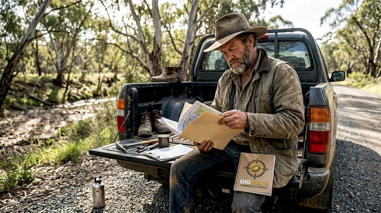
Use maps, historic records, and local secrets
Once you have the legal side sorted, your next step is stacking the odds in your favor with the right information. The best prospectors aren't just lucky. They're well-researched.
Geological maps are your foundation. Victoria's GeoVic platform and NSW MinView both offer free access to detailed geological datasets, including fault lines, rock types, and historic workings. These are the same datasets professional geologists use, and they're available to you right now. Historic goldfield records from State Library Victoria and Mines Department reports add another layer, revealing where past operations found payable gold and where they didn't.
Here's a step-by-step approach to building a solid research base before you set foot in the field:
- Pull the relevant geological map sheet for your target area from GeoVic or NSW MinView
- Overlay historic mining tenement boundaries to identify previously worked zones
- Cross-reference with State Library Victoria records for detailed field notes and assay reports
- Search local prospecting club forums and recent social media finds for current activity
- Mark your shortlist of target sites and rank them by geological favorability and access
Local prospecting clubs are genuinely underrated. Members often know which creeks are running color right now and which areas have been quietly productive for years. That kind of intelligence doesn't appear on any map.
Pro Tip: Don't dismiss old mining districts just because they've been worked before. Many were abandoned due to technology limitations, not lack of gold. Cross-referencing historic records with modern smarter site selection tools often reveals overlooked pockets.
Combining old data with new technology isn't just a nice idea. It's the single most reliable way to find sites that others have walked past.
Understanding geology for gold finding also helps you read the landscape more accurately, so you're not just following old workings but actually understanding why gold deposited there in the first place.
Integrate traditional fieldwork with AI-driven tools
After gathering reliable site information, it's time to turn boots-on-ground research into smart decision-making with digital backup. Traditional methods haven't gone anywhere. Panning, metal detecting, and direct sampling are still the core of small-scale operations. But integrating AI and satellite tools gives you a measurable edge, especially in regulated environments where you can't afford to disturb ground without a strong reason.
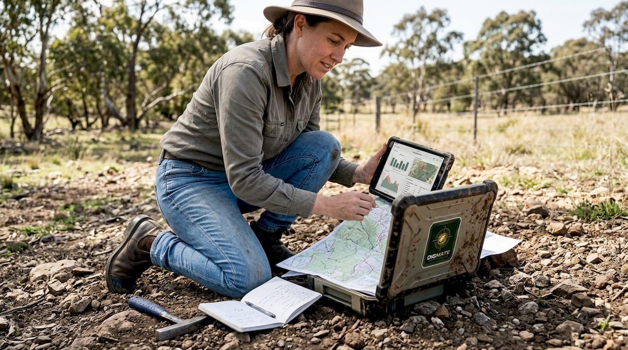
AI tools work by recognizing patterns across large datasets, including satellite imagery, geochemical surveys, and historic production data, that no human could process manually. They can flag anomalies in vegetation, soil composition, and terrain that correlate with known mineral deposits. For small operations, this means spending less time on unproductive ground.
| Workflow | Typical yield | Risk level | Upfront cost |
|---|---|---|---|
| Traditional only | Moderate | High (trial and error) | Low |
| AI-assisted | Higher | Lower (data-informed) | Medium |
| Combined approach | Highest | Lowest | Medium-High |
Digital tools worth adding to your kit:
- AI and geospatial tools for satellite-based anomaly detection
- AI prospecting tools for mineral signature analysis
- Geodata platforms for layered mapping and target ranking
- Mobile field apps for logging samples and GPS-tagging finds in real time
Pro Tip: Use AI tools specifically to filter greenfield sites before committing to fieldwork. Running a digital pre-screen can cut your unproductive site visits by more than half, which means more time and money spent on ground that actually pays.
Upgrade your approach: Continuous learning and cost control
Blending on-the-ground wisdom with new tech is one thing. Growing smarter and leaner as you go sets you apart in a tough field.
One of the most practical strategies for small operations is the incremental permit approach. Starting with a Miner's Right or prospecting license for initial surveys lets you gather data and prove up a site before committing to the cost of a full exploration or mining lease. This staged approach reduces financial exposure significantly.
Cost sharing is another underused strategy. Pooling equipment with other small operators, sharing data from adjacent tenements, and splitting the cost of professional geological reports all make serious exploration more accessible. Digital platforms make data pooling easier than ever.
A numbered approach to smarter, cheaper project upgrades:
- Start with desktop research using free government datasets before spending on fieldwork
- Use AI pre-screening to rank target sites and cut unproductive visits
- Pool resources with local prospecting groups for equipment and data
- Document every field visit with structured reports to build a refinable dataset
- Revisit and update your site model after each trip using new finds and samples
| Activity | Without AI | With AI-enabled workflow |
|---|---|---|
| Site pre-screening | 3 to 5 days manual | 2 to 4 hours automated |
| Unproductive site visits | 60 to 70% of trips | 20 to 30% of trips |
| Report preparation | 1 to 2 days | 2 to 4 hours |
Continuous learning matters just as much as the tools you use. Following prospecting best practices for 2026 and exploring gem prospecting strategies keeps your methods sharp and your results improving over time.
Why small-scale prospectors are poised for the next gold rush
Conventional wisdom says big mining companies hold all the advantages. They have the capital, the geologists, and the equipment. But that thinking misses something important about how mineral discovery actually works in 2026.
Nimble, tech-savvy small teams can test a hypothesis, pivot, and move to a new target faster than any large operation can process a board approval. Major companies carry bureaucratic weight that slows them down. You don't. When a new alluvial find surfaces in a Victorian creek or a NSW ridge shows anomalous geochemistry, you can be on-site within days.
The real edge comes from combining that speed with the same quality of data that large operators use. AI tools have democratized access to serious analytical capability. Following best practices for prospectors and pairing them with modern platforms means you're no longer outgunned on information. You're just faster and more flexible. History shows that many significant finds come not from the biggest teams, but from the most curious and adaptable ones.
Supercharge your mineral exploration with DigMate
Ready to put these strategies to work? DigMate brings together AI-driven site analysis, historic records, geospatial mapping, and compliance tools into one platform built specifically for prospectors and small-scale miners in NSW and Victoria. Instead of juggling spreadsheets, government portals, and paper maps, you get a single dashboard that helps you find better sites faster and with less risk.
Whether you're planning your first fossicking trip or managing multiple tenements, DigMate's AI features are designed to reduce wasted effort and surface opportunities that manual research misses. Explore what's possible for your next project at the DigMate app and take your prospecting to the next level.
Frequently asked questions
What permit do I need to start mineral exploration in Victoria?
To start fossicking in Victoria, you need a Miner's Right. Additional permits are required if you plan to use mechanical methods like sluicing or highbanking.
How can AI tools help me find minerals in NSW and Victoria?
AI tools analyze satellite and historic data to highlight promising sites and reduce exploration risk, saving you significant time and money on unproductive ground.
Where do I find reliable historic goldfield records for Victoria?
The State Library Victoria holds historic goldfield maps and Mines Department reports that are essential for pre-field research and site planning.
Is small-scale mining still profitable in 2026?
Yes. With the right permits, solid data research, and AI tools for juniors, small-scale mining remains highly viable and increasingly efficient in both NSW and Victoria.