
TL;DR:
- Proper planning and understanding permits are crucial to successful mineral surveys in NSW and Victoria.
- Combining geochemical, geophysical, and AI tools enhances accuracy in site selection and anomaly detection.
- Field validation and thorough documentation are essential to avoid costly mistakes and ensure regulatory compliance.
Most mineral surveys in New South Wales and Victoria fall short not because of bad fieldwork, but because of missing pieces. Surveyors show up with solid gear and genuine motivation, then hit walls: wrong permits, single-method approaches that miss shallow anomalies, or AI outputs that get taken at face value without ground-truth confirmation. The result is wasted time and burned budgets. This guide closes those gaps by walking you through the regulatory groundwork, the right combination of survey methods, how to use AI tools the smart way, and what to do with your results once the fieldwork is done.
Table of Contents
- Preparing for mineral surveys in NSW and Victoria
- Step-by-step: Conducting the survey
- Common mistakes and how to avoid them
- Interpreting results and next steps
- A better way forward: Why smart surveys beat old-school guesswork
- Streamline your mineral survey with DigMate
- Frequently asked questions
Key Takeaways
| Point | Details |
|---|---|
| Multi-method surveys win | Combining geochemical, geophysical, and AI techniques increases target accuracy and reduces survey time. |
| Regulatory insight pays | Securing the right licences and complying with rehabilitation rules prevent costly mistakes and legal sanctions. |
| AI boosts, not replaces fieldwork | AI-driven analysis accelerates results but must always be validated by on-the-ground sampling and observation. |
| Data quality determines outcomes | Well-kept records and careful interpretation are vital for reporting, advancing to mining, or attracting investment. |
Preparing for mineral surveys in NSW and Victoria
A survey that starts without proper preparation rarely recovers. Before you pick up a sampling kit or switch on a detector, you need to understand the legal landscape and match your tools to your target area.
The regulatory starting point
The rules differ significantly between states. In NSW, mineral surveys require mineral titles issued under the Mining Act 1992, covering exploration geochemistry (soil, stream sediment, vegetation, and groundwater sampling), exploration geophysics (airborne and ground surveys including magnetics, gravity, and electrical methods), and exploration drilling using methods like RAB, air core, RC, and diamond. Critical minerals work can be funded through NSW's Critical Minerals Program, but the title must be in place first.
In Victoria, the governing legislation is the Mineral Resources (Sustainable Development) Act 1990, which requires an Exploration Licence for any survey activity that goes beyond basic fossicking. Licence holders must follow the Code of Practice for Mineral Exploration, which sets out how to minimize environmental impacts, and must submit reports to Resources Victoria. If you plan to transition from exploration to mining, work plans and environmental bonds apply.
Getting your legal requirements for mineral surveys sorted before arriving on site is not just good practice. It is the difference between a productive field season and a costly one.
Site selection using geoscientific and digital data
Smart site selection draws on multiple data layers. Start with geological maps from Geoscience Australia and state geological surveys to identify prospective rock types. Overlay historical mining records and old workings, which often signal where mineralization is already confirmed. Then add satellite imagery to assess surface expression, including vegetation stress anomalies that can indicate underlying geochemical signatures.
AI platforms accelerate this process significantly by processing these layers together and flagging priority zones. Cross-reference what the algorithm suggests against your own understanding of local geology, since no tool replaces field knowledge. For targeted smarter prospecting tips specific to NSW and Victoria, regional knowledge is a genuine advantage.
| Required permission | Key equipment | AI and digital tools |
|---|---|---|
| NSW mineral title (Mining Act 1992) | Rock hammer, spade, sample bags | AI anomaly detection platform |
| VIC Exploration Licence (MRSDA 1990) | GPS unit, field notebook | Satellite imagery analysis tools |
| Landholder consent (crown and freehold) | Soil/sediment sampling kit | Geospatial mapping software |
| Fossicking permit (NSW Fossicking Districts) | Metal detector (fossicking only) | Remote sensing and drone imagery |
| Environmental bond (VIC mining transition) | Geophysical sensors (ground) | Historical data overlay tools |
Essential gear and AI tools for your survey:
- Soil and sediment sampling kits with labeled containers and chain-of-custody records
- GPS-enabled field tablet or rugged smartphone with offline map capability
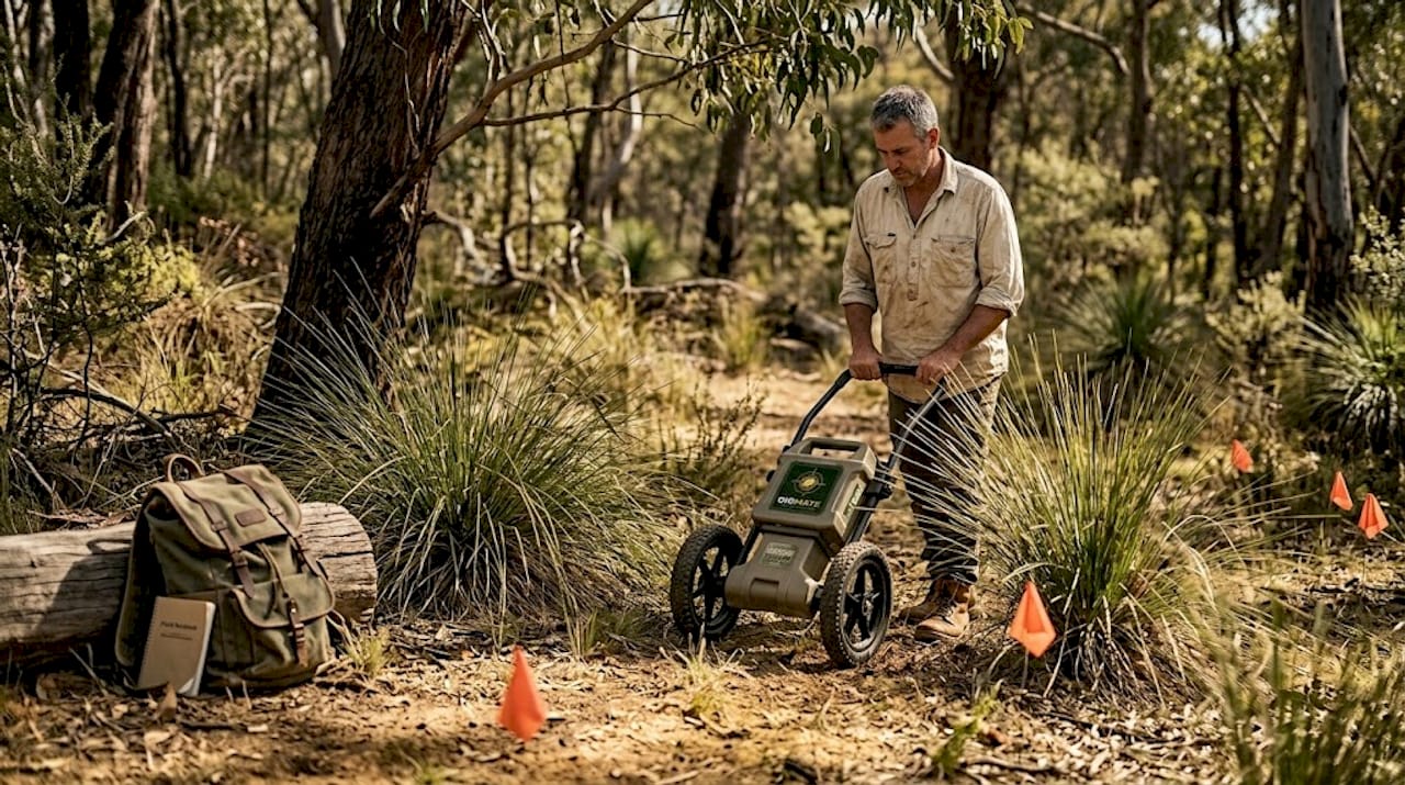
- Ground-penetrating geophysical equipment for professional surveys
- Metal detector for fossicking-scale reconnaissance
- AI-powered mineral detection platform with geospatial mapping
- Portable assay or XRF unit for rapid field screening
- Camera and voice recorder for thorough site documentation
Pro Tip: Secure all permits and written landholder consents before arriving at the site. Verbal agreements are not enough, and showing up without documentation can shut down a survey instantly and expose you to penalties.
Step-by-step: Conducting the survey
With permissions and equipment in hand, here's how to execute each critical stage of a mineral survey.
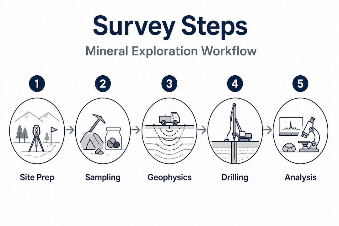
1. Geochemical sampling
Geochemical sampling is usually your first active survey method. Soil sampling targets the B or C horizon to capture secondary dispersion halos around buried mineralization. Stream sediment sampling is highly effective in drainage-dominated terrains across both states, since fine-grained sediment concentrates heavy minerals from a wide catchment area. Vegetation sampling (biogeochemistry) works particularly well in deeply weathered NSW terrain where plants draw up trace elements through root systems. Water sampling suits geothermal or fault-controlled targets.
Systematic grid sampling with consistent sample spacing gives you data that's actually comparable across the survey area. Take field duplicates at roughly 10% of sites to check repeatability, and document every sample location with GPS coordinates.
2. Geophysical methods
Ground geophysics typically follows geochemical work to investigate anomalies in more detail. Magnetic surveys reveal iron-bearing rock structures and alteration zones associated with gold and base metal deposits. Induced polarization (IP) surveys detect sulfide-bearing zones that often host gold. Gravity surveys map density contrasts at depth, useful for identifying buried intrusive bodies.
A multi-method approach combining geochem, geophysics, and drilling is strongly recommended for high-potential targets, especially in regolith-covered terrains like the NSW Lachlan Orogen and the Victorian Goldfields, where surface expressions can be subtle or misleading.
3. Drilling (where permitted)
Drilling converts geophysical and geochemical anomalies into real data about what's below surface. RAB (rotary air blast) and air core drilling are cost-effective for shallow targets and regolith sampling. RC (reverse circulation) drilling reaches depths of 200 to 400 meters and provides clean, uncontaminated chips for analysis. Diamond drilling recovers continuous core and gives you the best geological information for deep or structurally complex targets.
All drilling requires the appropriate mineral title in NSW or Exploration Licence in Victoria. Environmental management during and after drilling, including site rehabilitation, is mandatory.
4. Incorporating AI and satellite data at each step
AI tools are most valuable at the pre-survey stage (site selection), during data interpretation (anomaly ranking), and at the integration stage (correlating multiple datasets). AI prospecting tools can process weeks of manual data review in hours and flag patterns that a single analyst might miss.
"AI reduces survey time from months to days or weeks, but ground-truth is essential." Research from CSIRO's mineral discovery tools confirms this tradeoff: speed gains are real and substantial, but anomalies identified by algorithms must be validated in the field before committing significant drilling budgets.
The table below compares the three main approaches to mineral surveys in practical terms.
| Method | Speed | Cost | Depth capability | Best use case |
|---|---|---|---|---|
| Classical (geochem/geophysics only) | Slow (months) | Moderate | Surface to intermediate | Well-understood terrains |
| AI-enhanced (satellite/algorithm-led) | Fast (days/weeks) | Lower upfront | Surface focused | Greenfield reconnaissance |
| Hybrid (AI + field validation + drilling) | Moderate (weeks) | Moderate to high | Full range | High-value, complex targets |
Pro Tip: Always validate AI leads with field observations before committing budget. Walk the anomaly, look at outcrop, check drainage patterns, and take a grab sample. An algorithm sees data. You see the actual ground.
The best workflows for both beginners and experienced professionals combine AI and geospatial tools during desk study, systematic fieldwork for geochemical and geophysical data collection, and then AI-assisted analysis to rank targets before any drilling decision. Using site selection tools digitally before you reach the field typically saves two to three weeks of trial-and-error reconnaissance.
Common mistakes and how to avoid them
Careful execution isn't enough if avoidable errors set you back. Here's what to watch for and how to fix issues fast.
The most common mistakes in mineral surveys:
- Skipping or misunderstanding permits: Operating without a valid mineral title or Exploration Licence exposes you to fines, site closure, and potential prosecution. NSW Fossicking Districts have specific rules about where consent is needed. Victoria requires licence conditions to be met at all times.
- Using the wrong equipment for the survey type: Power-operated equipment and explosives are prohibited in NSW fossicking activities, and material limits apply (10 kg of gold or gem-bearing material, 5 kg of other material, per person per 48 hours). Using an excavator without a mineral title is a significant offense.
- Ignoring or misreading geochemical data: Anomalies only mean something in geological context. A high gold reading in isolation doesn't confirm a deposit. Always compare anomalies to background levels and local geology.
- Over-relying on AI or sensor output: No algorithm or drone sensor replaces field observation. Drone-based electromagnetic and magnetics surveys are high-resolution but depth-limited compared to ground-based systems. Treat AI outputs as a hypothesis, not a conclusion.
- Failing to document properly: Poor field records create problems at the reporting stage. Missing GPS coordinates, unlabeled samples, and incomplete field notes make your data unusable and your report non-compliant.
- Neglecting environmental rehabilitation: This is not optional. Regulatory compliance requires environmental rehabilitation whether you found mineralization or not. Failure to rehabilitate is one of the fastest routes to prosecution and loss of licence.
"Environmental rehabilitation is mandatory under both NSW and Victorian mining regulations. Ignoring this step is not a minor oversight. It is a direct path to fines, prosecution, and exclusion from future licences."
Review NSW and Victoria best practices before each season, not just when you're starting out. Regulations update, and keeping current with compliance requirements protects your licence and your reputation. Following solid prospecting best practices in 2026 means treating compliance as a core competency, not an afterthought.
Interpreting results and next steps
With fieldwork complete, meaningfully interpreting results is essential to determine what's possible next.
-
Clean and validate your data. Remove samples flagged as contaminated or procedurally compromised. Check for lab errors by comparing field duplicates to primary samples. Anomaly detection is only reliable when your dataset is clean.
-
Apply statistical analysis to identify meaningful anomalies. Use threshold calculations (median plus two standard deviations is a common baseline) to separate background noise from genuine signals. Map anomalies spatially to identify clusters or trends aligned with known geological structures.
-
Correlate geochemical results with geophysical data. A gold-in-soil anomaly that aligns with an IP chargeability high and a magnetic low is a much stronger target than a standalone geochemical hit. Geodata analysis tips help you understand what combinations of signals actually mean in the context of the specific terrain.
-
Validate with repeat sampling. Before committing to a drilling program, return to your top three anomalies and re-sample independently. This step eliminates false positives and protects your drilling budget.
-
Determine the right next step. If anomalies are confirmed and geologically coherent, the path forward is usually infill geophysics or a scout drilling program. If anomalies are weak or isolated, rehabilitation and site exit may be the most cost-effective decision. Understanding how geology drives interpretation helps you make that call with confidence.
-
Prepare and submit reports. In Victoria, reports go to Resources Victoria under the Exploration Licence conditions set by the Mineral Resources (Sustainable Development) Act 1990. In NSW, reporting obligations depend on the mineral title type. Both jurisdictions require documentation of methods, results, and environmental management actions.
Pro Tip: Always double-check anomalies with independent repeat sampling before moving to drilling. A second set of samples collected by a different team member using the same protocol is your best insurance against wasted drilling spend.
A better way forward: Why smart surveys beat old-school guesswork
Here's an opinion that experience keeps confirming: most survey failures in NSW and Victoria are not equipment failures. They're planning failures. A prospector with a top-of-the-range ground geophysics system but no geochemical baseline data is working blind in one eye. A geologist with great soil data but no idea what structure controls the mineralization is guessing at depth.
Single-method surveys are the biggest silent killer of exploration programs in this country. The geology in both states is genuinely complex: regolith-covered basement in NSW, structurally complex Paleozoic terrains in Victoria, and deeply weathered profiles that make surface expression unreliable. No single method cuts through all of that. The combination does.
The contrarian view worth stating clearly: don't trust any AI tool, drone sensor, or algorithmic output until you've physically walked the anomaly and documented what you saw. This is not anti-technology. The next-gen AI tools available to prospectors and exploration companies today are genuinely powerful. But their power comes from processing patterns at scale, not from understanding local geological context the way an experienced person on the ground does.
The best surveyors we see succeed consistently are not the ones with the most expensive hardware. They're the ones who invest equally in understanding the rules, learning the tools, and building the field experience to know when the machine is right and when it needs to be questioned. That combination, regulatory literacy plus technical skill plus digital efficiency, is the actual competitive advantage in 2026 mineral exploration.
Streamline your mineral survey with DigMate
Putting all of this into practice takes more than a checklist. It takes tools that work as fast as the field demands, with data layers that are actually relevant to NSW and Victoria prospecting.
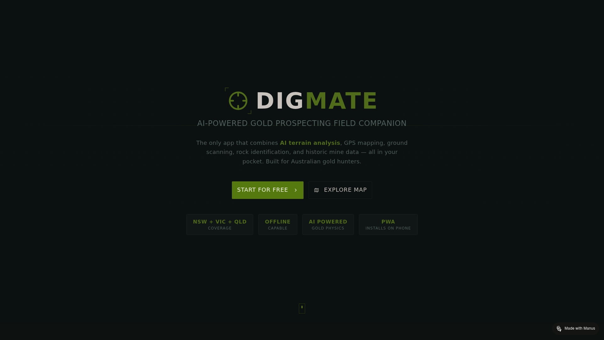
The DigMate platform is built specifically for prospectors and mining professionals operating in these two states. DigMate integrates AI-driven anomaly detection, geospatial mapping, and compliance-relevant data into a single interface that works whether you're planning from home or checking targets from a remote field location. Explore the full range of prospecting features designed to replace guesswork with data-backed decisions, or take a closer look at the AI ground scan tools to see how the platform supports every stage of your survey workflow, from initial site selection through to result interpretation and reporting.
Frequently asked questions
Do I need special permits to conduct a mineral survey in NSW or Victoria?
Yes. In NSW, mineral titles are required under the Mining Act 1992 for any formal survey, and in Victoria an Exploration Licence is mandatory for survey activity beyond basic fossicking.
Can I use metal detectors or drones when fossicking in NSW or VIC?
Metal detectors are generally permitted for fossicking, but power-operated equipment is prohibited in NSW fossicking activities, and drones used for active surveying typically require additional approvals and an appropriate mineral title.
How does AI help with mineral surveys?
AI dramatically speeds up anomaly detection and data integration across multiple layers, with CSIRO research confirming time reductions from months to days or weeks. Field validation of AI-identified targets remains essential before any major investment decision.
What reporting requirements exist after a survey?
Victoria requires formal reports to Resources Victoria under Exploration Licence conditions, covering methods, results, and environmental management. NSW reporting obligations vary by mineral title type but always require documented site rehabilitation.
What are the most common mistakes first-time prospectors make?
The most damaging errors are skipping permits, misunderstanding fossicking rules, and treating AI outputs as definitive conclusions without field validation. Regulatory compliance, including environmental rehabilitation, is mandatory in both states and should be treated as the foundation of every survey.