TL;DR:
- Effective mineral exploration in NSW and Victoria requires clear criteria, strategic tool deployment, and compliance.
- Advanced technologies like AEM, hyperspectral scanners, satellite imagery, and ML enhance greenfield targeting efficiency.
- Success depends on integrating data-driven workflows, government support, and adherence to evolving environmental regulations.
Mineral exploration in New South Wales and Victoria has never been more competitive. The combination of rising global demand for critical minerals, tighter environmental regulations, and a wave of AI-powered field tools means that gut instinct alone no longer cuts it. Whether you are an individual prospector hunting alluvial gold or a company targeting deep greenfield deposits, the margin between a productive campaign and an expensive dead end comes down to how well you plan, what tools you deploy, and how closely you follow the rules. This guide breaks down the criteria, techniques, and compliance essentials you need to run a smarter operation in 2026.
Table of Contents
- Define your exploration criteria: What matters most in 2026
- Techniques and tools for smarter site identification
- Side-by-side: Comparing modern prospecting methods
- Compliance, sustainability, and regulatory best practices
- Planning your prospecting campaign: What actually works in the field
- What most prospectors miss about best practices in 2026
- Take your prospecting to the next level with DigMate
- Frequently asked questions
Key Takeaways
| Point | Details |
|---|---|
| Prioritize advanced criteria | Defining target minerals, compliance needs, and tech requirements optimizes your campaign from day one. |
| Leverage modern tools | AI, ML, and satellite data are essential for rapid and accurate site targeting in 2026. |
| Stay compliant | Strict legal limits and environmental obligations shape what tools and methods you can use. |
| Integrate data for results | Continuous feedback loops and real-time analysis dramatically boost field efficiency. |
Define your exploration criteria: What matters most in 2026
Before you book a flight or load the ute, you need a clear framework. Jumping into the field without defined criteria is one of the most common and costly mistakes we see. The good news is that a structured pre-exploration checklist keeps you focused and dramatically reduces wasted days on unproductive ground.
Here are the essential criteria every prospector and exploration team should lock in before breaking ground:
- Target deposit type: Are you chasing gold, lithium, cobalt, or rare earth elements? Each has different geophysical signatures and requires different tools.
- Regulatory limits: Understand what is permitted under your specific tenure type in NSW or Victoria before you arrive on site.
- Permitted tools: Recreational fossickers and licensed exploration companies operate under very different rules. Know which category you fall into.
- Site access: Crown land, private property, national parks, and Aboriginal heritage areas each carry distinct access requirements.
- Sustainability requirements: Environmental impact assessments and site rehabilitation plans are now baseline expectations, not optional extras.
Greenfield sites in both states increasingly demand a tech-first approach. With 130 critical minerals projects in 2025 across Australia (70% at early stage), and NSW and Victoria each hosting around 10 of those projects, the regional focus on high-potential greenfields is clear. That means deeper data layers, better pre-field modeling, and more rigorous target ranking before you spend a dollar on drilling.
Follow the prospecting guidelines NSW/VIC to make sure your framework aligns with current state requirements.
Pro Tip: If you are targeting critical minerals in NSW, map your exploration sequence to match co-funding or grant requirements under the Critical Minerals Exploration Program. Aligning your work plan to grant milestones can significantly offset early-stage costs.
Techniques and tools for smarter site identification
The toolkit available to modern prospectors in 2026 is genuinely impressive. But more tools does not automatically mean better results. Knowing when and why to deploy each technology is what separates efficient teams from those burning budget on the wrong method.
Here is a breakdown of the key technologies in use across NSW and Victoria:
- pXRF (portable X-ray fluorescence): Fast, non-destructive elemental analysis in the field. Ideal for soil and rock chip sampling at shallow targets.
- Portable hyperspectral scanners: Identify mineral assemblages from drill core or outcrop in real time. Excellent for alteration mapping.
- HyLogger: Automated hyperspectral core logging used widely in Australian state core libraries for rapid mineralogy.
- AEM (airborne electromagnetic): Covers large areas quickly and detects conductive bodies beneath cover. Best for regional reconnaissance.
- MT (magnetotellurics): Images deep crustal structure. Useful for identifying basement architecture under thick sedimentary cover.
- Seismic surveys: High-resolution imaging of deep stratigraphy and fault systems. Cost-intensive but powerful for advanced-stage targeting.
- Satellite data: The CSIRO PRISMA, EnMAP, and EMIT satellites deliver continental mineralogy updates at 30 to 60m resolution on roughly a 28-day cycle, making them a practical greenfield screening tool.
The NSW Government co-funds geochemistry, geophysics, and deep drilling under its Critical Minerals program, particularly for greenfield targets. That means well-designed programs using these tools can attract government support.
For undercover terrain, the UNCOVER initiative in the Southern Thomson region integrates geochemical and AEM surveys with stratigraphic drilling to unlock deep resource potential. This multi-method approach is now the benchmark for serious greenfield work.
Explore smarter site selection tools and AI prospecting tools for a deeper look at how these technologies are being applied across the region.
Pro Tip: Combine ML-powered workflows like LithoBound with new petrophysical datasets. This pairing enables dynamic, field-based decision-making that traditional static models simply cannot match. Learn more about regolith interface identification and how it supports faster target refinement.
Side-by-side: Comparing modern prospecting methods
Choosing the right method depends on your ground conditions, budget, and target depth. The table below gives you a direct comparison of the most widely used approaches in NSW and Victoria.
| Method | Depth range | Speed | Cost | Best use case |
|---|---|---|---|---|
| AEM | Shallow to mid | Fast | Moderate | Regional cover mapping |
| MT | Deep | Moderate | High | Basement imaging |
| Seismic | Deep | Slow | Very high | Advanced structural targeting |
| pXRF | Surface | Very fast | Low | Soil/rock chip sampling |
| Portable hyperspectral | Surface to core | Fast | Moderate | Alteration mapping |
| Satellite imagery | Surface | Continuous | Low | Greenfield screening |
Key advantages and trade-offs to keep in mind:
- AEM covers ground fast but has limited depth penetration in resistive terrain.
- MT resolves deep structure but requires specialist processing and longer field campaigns.
- Seismic delivers the clearest deep images but is rarely justified before advanced-stage targeting.
- pXRF is fast and affordable but only tells you what is at the surface.
- Portable hyperspectral is powerful for alteration mapping but requires trained interpretation.
- Satellite data updates at 30 to 60m resolution every 28 days, making it one of the most cost-effective screening tools available for greenfield work.
Teams that integrate satellite screening with ML-driven analysis have reported significant reductions in time spent on unproductive ground before committing to expensive ground-based surveys. That is a real operational advantage when you are managing a tight exploration budget.
For a deeper look at how AI and geospatial tools are changing the economics of site selection, the efficiency gains are well documented and growing.
Compliance, sustainability, and regulatory best practices
Ignoring compliance is not just a legal risk. It can shut down your entire operation and damage your reputation with landowners and regulators for years. The rules in NSW and Victoria are specific, and they differ significantly depending on whether you are a recreational fossicker or a licensed exploration company.
Key restrictions and requirements to know:
- NSW fossicking: Restricted to hand tools, 10kg per person per 48 hours, maximum 1 cubic meter of disturbance, no power tools permitted.
- Private land and national parks: You need written consent from the landowner or relevant authority before entering.
- Environmental rehabilitation: All disturbed ground must be rehabilitated to the satisfaction of the relevant authority.
- Reporting duties: Licensed exploration companies must submit regular activity reports and notify authorities of significant finds.
- Prohibited areas: Heritage sites, water catchments, and certain conservation zones are off-limits regardless of tenure.
"Fossicking in NSW is restricted to hand tools, 10kg per person per 48 hours, 1 cubic meter of disturbance, no power tools, and is not permitted on private or national park land without consent." NSW Resources
The gap between recreational and company-scale operations is significant. A company holding an exploration license has far greater access but also far greater reporting and rehabilitation obligations. Make sure your compliance checklist matches your tenure type. Review the fossicking rules and best practices for a state-by-state breakdown.
Planning your prospecting campaign: What actually works in the field
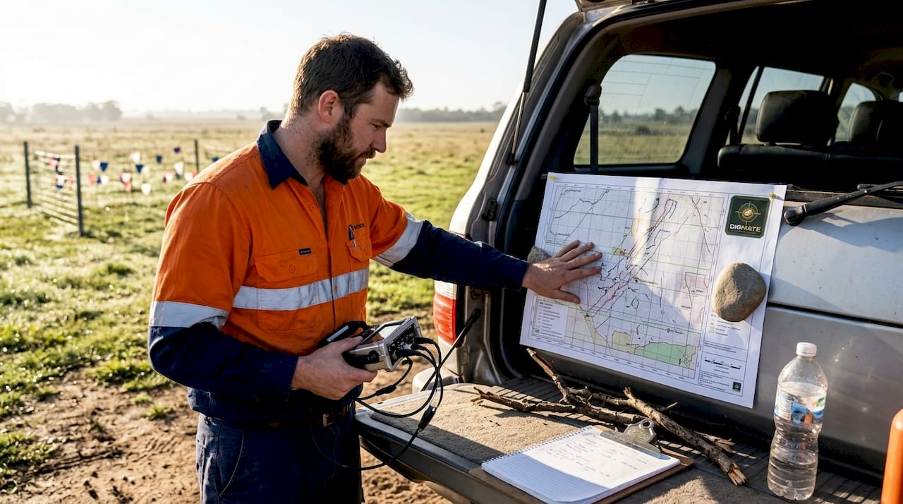
A well-structured campaign is the difference between finding something and finding nothing. Here is a practical, step-by-step sequence that works for both individual prospectors and exploration teams operating in NSW and Victoria.
- Pre-fieldwork data gathering: Pull all available government geoscience data, satellite imagery, and historical reports for your target area. Apply for relevant grants or co-funding before committing field budget.
- Site access confirmation: Secure all necessary permits, landowner consents, and heritage clearances before you leave the office.
- Method and tool selection: Match your tool choice to the deposit type, depth, and terrain. Use the comparison table above as your starting point.
- In-field sampling and analysis: Deploy pXRF and portable hyperspectral tools for rapid on-site feedback. Adjust your sampling grid based on real-time results.
- Compliance and reporting: Document everything as you go. Do not leave compliance paperwork until the end of the campaign.
- Post-campaign review: Revisit your criteria and results. Adjust your target model for the next phase.
The LithoBound workflow is a strong example of how integrating pXRF, hyperspectral tools, and ML can rapidly refine target zones and cut time spent on unproductive ground. Dynamic adjustment based on real-time data is now a baseline expectation for efficient campaigns.
Understanding the importance of geodata is central to making these adjustments confidently and quickly.
Pro Tip: Keep a digital log of every decision, tool reading, and site observation throughout your campaign. This makes compliance audits faster and gives you a structured dataset to improve your next campaign.
What most prospectors miss about best practices in 2026
Here is the uncomfortable reality: most prospectors either over-rely on tradition or chase the latest gadget without a clear decision framework. Both approaches waste money and time. The real edge in 2026 comes from something less exciting but far more powerful: integrating government data, ML-powered feedback loops, and compliance-aware planning into a single, adaptive workflow.
The teams consistently finding results in NSW and Victoria are not necessarily using the most expensive equipment. They are the ones revisiting and adjusting their campaign criteria after every new dataset comes in. That iterative discipline is what separates productive exploration from expensive wandering.
Success in this region increasingly depends on public-private innovation. Government geoscience data, co-funding programs, and open-access satellite datasets are all available right now. The prospectors who use them systematically, and who treat compliance as a feature rather than a burden, are the ones building durable, scalable operations.
For a detailed look at how AI efficiency translates into real field outcomes, the evidence is clear: adaptive, data-driven campaigns consistently outperform static, tradition-bound ones.
Take your prospecting to the next level with DigMate
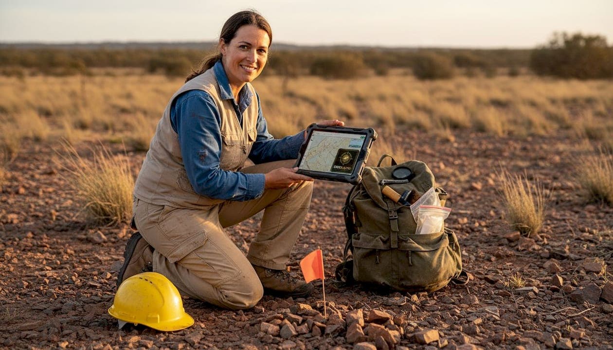
Running a smarter campaign in 2026 means having the right digital tools in your corner from day one. DigMate is built specifically for prospectors and exploration teams operating in NSW and Victoria, combining AI-driven mineral detection, geospatial mapping, and real-time data analysis into one platform.
Whether you are screening greenfield targets, tracking compliance obligations, or making in-field decisions faster, the DigMate prospecting tools are designed to cut through the noise and point you toward productive ground. Check out the full AI-powered feature list to see how the platform accelerates every stage of your exploration workflow. You can also access free gold maps to start identifying high-potential areas in your region today.
Frequently asked questions
What are the biggest changes in prospecting regulations for 2026?
The focus is on stricter site disturbance limits, advanced reporting standards, and increased enforcement of environmental rehabilitation in NSW and Victoria. NSW fossicking rules set specific ore and disturbance limits, with tech-powered enforcement becoming more common.
Which prospecting tools deliver the fastest results in undercover terrain?
In NSW and Victoria, combining AEM, MT surveys, and ML-powered workflows like LithoBound rapidly narrows down target zones. LithoBound integrates ML and field data for dynamic boundary detection under cover.
How often is mineralogical satellite data updated in Australia?
CSIRO's PRISMA, EnMAP, and EMIT satellites update continental mineral maps every 28 days at 30 to 60m resolution, making them a practical tool for ongoing greenfield targeting.
What is the maximum amount of mineral-bearing ore a recreational prospector can collect in NSW?
Up to 10kg per person every 48 hours is allowed, using only hand tools and obeying site-specific restrictions on disturbance and access.
Are there co-funding opportunities for mineral exploration in NSW?
Yes, the NSW Critical Minerals program co-funds advanced geochemistry, geophysics, and drilling, especially for greenfield targets with strong technical merit.