TL;DR:
- Gold in NSW and Victoria is concentrated in specific geological formations like orogenic lodes and alluvial deposits.
- Prospectors should analyze structural geology, historical data, and geomorphology to target potential gold sources.
- Technology tools like DigMate's AI mapping enhance exploration by integrating formation knowledge with real-time geospatial data.
Every experienced prospector in New South Wales and Victoria knows that picking up a detector and heading into the field without understanding your target formation type is the fastest route to wasted time and money. Gold doesn't occur randomly. It concentrates through specific geological processes, and the formation type you're chasing directly controls where you dig, which tools you use, and how you interpret the ground beneath your boots. This guide breaks down the full spectrum of gold formation types across NSW and Victoria, giving you the practical framework to match your exploration strategy to the geology underfoot.
Table of Contents
- Selection criteria: What defines a valuable gold formation?
- Primary (lode) gold formations: Origins and signatures
- Alluvial and secondary deposits: Types and field indicators
- Less common and edge-case gold formations
- When to target which formation: Practical exploration strategies
- What most prospectors overlook about gold formations in NSW and Victoria
- Supercharge your fieldwork with DigMate's AI-powered gold mapping
- Frequently asked questions
Key Takeaways
| Point | Details |
|---|---|
| Know your gold types | Distinguishing between primary, alluvial, and rare formation types is crucial for smart exploration and increased finds. |
| Structure guides success | Targeting structural controls in lode systems and geomorphological cues in alluvials raises discovery chances. |
| Data-driven choices | Using tables and practical tips lets you prioritize the best sites for fieldwork. |
| Adapt your tactics | Let formation type shape your approach—don’t use the same methods for every goldfield. |
Selection criteria: What defines a valuable gold formation?
Before you can prioritize targets, you need a clear framework for evaluating them. Not every gold formation offers the same prospecting opportunity, and experienced operators weigh multiple factors before committing resources to a site.
The geological controls matter most. Structural controls on gold such as faults, folds, and lithology contrasts (meaning boundaries between different rock types) are the plumbing systems that channel gold-bearing fluids. Primary gold deposits in eastern states like NSW and Victoria form through hydrothermal processes where hot fluids dissolve gold from surrounding rocks and deposit it in veins as they cool, most often associated with quartz. Knowing which rock types are present at a given location tells you whether the right plumbing even exists.
Economic considerations run a close second. Depth, terrain accessibility, historical yield data, and proximity to existing infrastructure all feed into a realistic assessment. A high-grade lode system 400 meters underground means little to a small exploration team without drilling capacity. Conversely, a shallow alluvial field with documented historical production might be accessible within days.
Key evaluation criteria you should apply to any target include:
- Historical records: Old mining reports, surveyor logs, and government geological records often contain gold production data that dramatically cuts exploration risk.
- Structural position: Is the site located along a known fault corridor or fold axis? These are your highest-probability zones.
- Host rock: Turbidites (layered sedimentary sequences) and volcanic rocks host the majority of NSW and Victorian primary deposits.
- Weathering profile: Oxidized zones near surface are cheaper and easier to sample and mine than fresh sulfide ore at depth.
- Geomorphic setting: For alluvial targets, you're reading the landscape differently. Gullies, paleochannels, and heavy mineral concentrations in stream sediments are your key indicators.
For primary targets, the prospecting methodology focuses on structural zones and lithology boundaries in turbidites and volcanics. For alluvial targets, geomorphology drives everything, with gullies, paleochannels, and heavy mineral trains pointing the way.
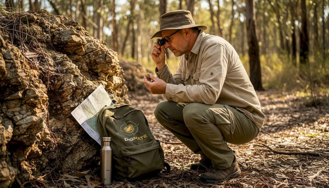
Pro Tip: Pull every available historical report before you set foot in the field. Geological Survey of NSW and Resources Victoria both maintain public databases where old miners recorded diggings, yields, and formation observations that no amount of modern scanning can replace.
"The most overlooked resource in Australian gold exploration is the archive, not the ground itself."
Primary (lode) gold formations: Origins and signatures
With identification criteria in hand, let's examine the main gold formation categories, beginning with hard-rock lode systems.
Primary, or lode, gold deposits in NSW and Victoria are dominated by orogenic gold systems. Orogenic refers to gold that forms during mountain-building events when deep crustal fluids are expelled upward through fault networks. These are the formations that built the legendary goldfields of central Victoria and the historic diggings of NSW.
Two main subtypes operate across the region:
-
Mesozonal orogenic deposits form at depths of roughly 6 to 12 kilometers during deformation events. They produce the classic saddle reefs and trough reefs you see in reverse fault systems. Bendigo and Ballarat are textbook mesozonal systems. Orogenic gold deposits are the dominant primary type in Victoria, forming during Late Ordovician to Silurian and Late Devonian deformation in turbidite sequences, and central Victoria's mesozonal systems alone have produced more than 2,500 tonnes of gold historically.
-
Epizonal orogenic deposits form shallower, typically at 2 to 6 kilometers depth. They tend to be smaller, lower-temperature systems with different alteration signatures. The Melbourne Zone hosts examples of epizonal style mineralization. These systems are worth recognizing because they're often overlooked in favor of the bigger mesozonal targets.
The Bendigo gold system is arguably the world's most documented example of mesozonal orogenic gold, with its characteristic anticlinal reef geometry hosting bonanza grades across multiple mine levels. The Ballarat goldfield offers another variant, with reef systems that demonstrate how structural complexity within a single goldfield can produce vastly different local geometries.
In NSW, the Hill End goldfield adds an important dimension. Gold at Hill End formed syntectonically in Late Silurian slate and metagreywacke via metamorphic fluids, with temperatures between 110 and 350 degrees Celsius and characteristically low salinity. The fluid chemistry evolved from nitrogen-rich to methane-rich to CO2-rich with late-stage meteoric water influx. This multi-stage fluid evolution created the bedding-parallel and discordant quartz veins that define the field's geometry.
For a different setting entirely, Tomingley in central-west NSW demonstrates orogenic lode gold in a volcanic host. The Tomingley deposits sit within an Ordovician volcano-sedimentary sequence, where quartz veining and alteration are focused in andesitic volcanic rocks due to the rheological contrast they create relative to surrounding sediments. Total resources stand at 19 million tonnes at 2.2 grams per tonne for approximately 1.36 million ounces. This is an important reminder that volcanic host rocks, not just turbidites, can focus orogenic gold.
Field signs to look for in primary lode targets:
- Quartz vein networks, especially where multiple generations of veining intersect
- Carbonate alteration (ankerite, siderite) in wall rocks adjacent to veins
- Sulfide minerals including arsenopyrite, pyrite, and pyrrhotite in or near veins
- Saddle or anticlinal shapes in deformed sedimentary sequences
- Sudden changes in rock type (lithology contrasts) that acted as rheological traps for fluid flow
Alluvial and secondary deposits: Types and field indicators
After examining primary gold sources, it's vital to understand the various alluvial and secondary deposits that have fueled Victorian and NSW gold rushes.
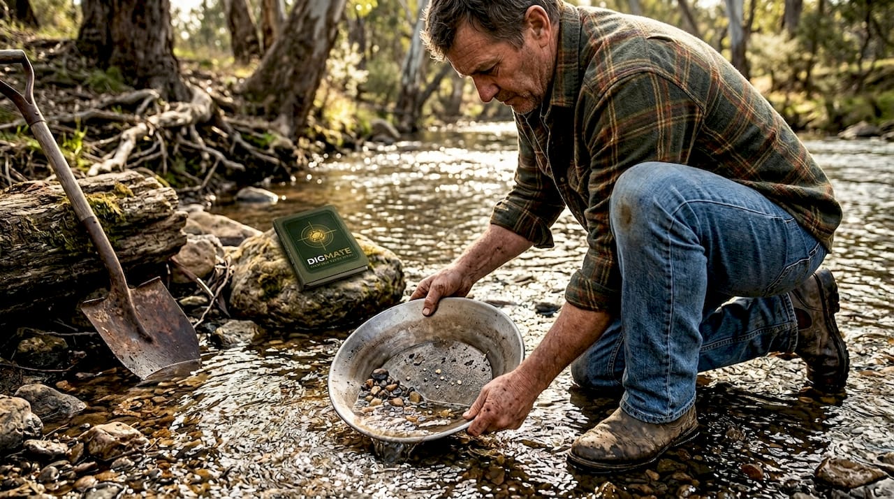
Alluvial gold is what most recreational prospectors encounter first, and for good reason. It's accessible, detectable with standard equipment, and has an enormous historical footprint across both states. But not all alluvial deposits are the same, and confusing one type with another leads to mismatched methods and missed gold.
Alluvial gold in Victoria includes four main secondary deposit categories:
| Deposit type | Setting | Depth | Primary exploration method |
|---|---|---|---|
| Shallow alluvial | Active/recent gullies and streams | Surface to 5m | Sluicing, metal detecting, panning |
| Deep lead | Buried paleochannels under basalt or gravel | 10m to 100m+ | Historical records, drilling, shafts |
| Eluvial and colluvial | Slopes near primary source | Shallow | Surface sampling, detecting |
| Top gravels (hilltop) | Eocene to Holocene cemented hilltop gravels | Surface to 15m | Sampling, shallow drilling |
The deep leads deserve special attention. These are ancient buried river systems, often sealed beneath younger basalt flows, that concentrated gold over millions of years. The Bendigo and Ballarat deep leads were major historical producers. Nuggets recovered from central and western Victoria often trace back to these deep lead sources or to nearby eluvial concentrations derived from weathering primary reefs.
Key field indicators for alluvial targets:
- Iron-stained gravels and sandy layers in creek beds or ancient drainage lines
- Lag deposits of heavy black sand (magnetite, ilmenite) indicating sorting by water
- "False bedrock" layers of cemented gravels that trapped gold during transport
- Visible ancient channels on LiDAR or topographic data running at angles to current drainage
- Productive local spots and known alluvial fields documented by historical prospectors
Pro Tip: Deep leads are routinely missed by surface detection methods. They sit below the detection depth of most handheld detectors. Your best approach is to study old shaft records and mining tenement maps that show where nineteenth-century miners successfully bottomed on gold-bearing gravels. Then map the channel geometry and target the unworked margins.
For NSW prospectors, the alluvial fields near Albury-Wodonga and further north present similar opportunities, particularly where drainage systems head downstream from known primary lode districts. The Bright alluvial gold fields in northeastern Victoria are a strong example of where river morphology and proximity to orogenic sources combine to concentrate recoverable gold in accessible settings. Successful alluvial gold detection in these zones comes down to reading the water's work over geological time.
Less common and edge-case gold formations
Beyond the major primary and alluvial sources, several less common deposit types occasionally surface and can confuse even experienced prospectors.
Two formation types worth understanding are Volcanic-Hosted Massive Sulfide (VHMS) deposits and intrusion-related gold systems. Neither dominates the NSW or Victorian gold landscape, but both appear in the geological record and occasionally produce significant mineralization.
VHMS deposits and intrusion-related gold are minor deposit types relative to the dominant orogenic systems across Victoria and NSW. However, knowing how to recognize them prevents misidentifying anomalous zones during mapping or drilling.
| Formation type | Key minerals | Typical setting | Historic example |
|---|---|---|---|
| VHMS | Pyrite, chalcopyrite, sphalerite, gold | Submarine volcanic sequences | Currawong Cu-Zn-Au, Victoria |
| Intrusion-related gold | Scheelite, bismuth, gold, arsenopyrite | Felsic intrusion contact zones | Cadia, NSW |
| Orogenic lode | Quartz, ankerite, arsenopyrite, gold | Fault zones in turbidites/volcanics | Bendigo, Ballarat, Hill End |
| Alluvial | Free gold, magnetite, zircon | Drainage systems, paleochannels | Most Victorian gullies |
The Currawong copper-zinc-gold deposit in Victoria is the regional VHMS example. These systems form on ancient seafloors through volcanic exhalation and require a completely different targeting approach than orogenic gold. You're looking at different host rocks, different mineralogy, and different structural contexts.
At Cadia in NSW, a large intrusion-related copper-gold porphyry system shows that post-orogenic felsic intrusions can drive significant gold mineralization. Cadia operates at a different scale entirely from the average prospecting target, but recognizing the porphyry style in geochemical data or rock chips is useful when you're working in areas with known igneous intrusion histories.
Signals that suggest an edge-case formation rather than classic orogenic or alluvial:
- Massive sulfide zones without obvious quartz vein networks
- Gold associated with copper, zinc, or molybdenum rather than arsenic
- Gold anomalies spatially tied to granite or felsic porphyry intrusions
- Absence of the typical turbidite host rock that dominates Victorian orogenic systems
When to target which formation: Practical exploration strategies
Given this range of formation types, how can prospectors and teams efficiently prioritize targets and methods in their region of interest?
Matching formation type to your operational reality is how successful prospectors avoid burning budget on the wrong approach. Here's a practical sequencing framework:
-
Start with regional geology. Pull the state geological maps for your target area. Confirm whether you're in a turbidite belt (orogenic primary likely), a drainage corridor downstream from a known lode district (alluvial likely), or a volcanic sequence (VHMS or volcanic-hosted primary possible).
-
Layer historical production records. Historical yield maps, warden's court records, and old prospecting reports tell you which formation type was productive in your specific area. This step alone can eliminate formation types from consideration.
-
Target structural zones for primary deposits. For lode targets, use available aeromagnetic and gravity data to identify fault corridors, fold axes, and lithology boundaries. The best practices for gold prospecting in primary settings always center on structural interpretation first.
-
Use geomorphic analysis for alluvial targets. LiDAR elevation data reveals ancient drainage systems that modern creeks have buried or abandoned. Map the paleochannels, identify the likely upstream source, and target the inside bends and bedrock lows where gold concentrates.
-
Apply geochemical sampling to screen prospects. Stream sediment sampling for gold and pathfinder elements like arsenic and antimony helps rank prospects before you commit to expensive ground surveys or drilling.
Pro Tip: Blend your mapping with legacy geochemical data held in state government databases. NSW and Victoria both maintain publicly accessible geochemical data on gold from decades of past exploration. Cross-referencing this data with your structural interpretation reveals targets that previous operators missed when they focused on obvious outcrops.
What most prospectors overlook about gold formations in NSW and Victoria
The dominant tendency in exploration, especially among teams with limited budgets, is to chase the formation type that everyone already knows about. In Victoria, that means a rush toward obvious orogenic lode targets in Bendigo and Ballarat corridor rocks. In NSW, it means detector sweeps over known alluvial fields that have been worked since the 1850s. This focus is understandable but often self-defeating.
What gets systematically undervalued is the transitional zone: the weathered, oxidized upper portions of primary lode systems that grade into eluvial and colluvial concentrations downslope. These zones sit above the detection depth of most historical shaft mining, they're difficult to classify neatly as either primary or alluvial, and they're frequently left off both orogenic and alluvial target lists. They can be extraordinarily productive. The structural geology behind these transitions is well understood at the academic level, but rarely applied systematically in the field.
Legacy data is the second chronically underused asset. Particularly for edge-case formations and secondary deposits, old state survey records contain mineralogical descriptions, shaft depths, and production estimates that no amount of modern geophysical surveying can generate from scratch. Teams that invest time in the archive before the field consistently find targets faster than those who rely on airborne data alone.
"Real gains come from unconventional thinking and mapping what others ignore."
Modern exploration success in NSW and Victoria increasingly depends on fusing historical knowledge, geological modeling, and digital technology into a single workflow rather than treating them as separate disciplines.
Supercharge your fieldwork with DigMate's AI-powered gold mapping
If you're ready to put new knowledge to work, here's how technology can accelerate your next field campaign.
Understanding formation types is the intellectual foundation of smart prospecting. Turning that knowledge into on-ground results requires tools that can layer geological data, historical records, and real-time mapping into one accessible platform.

DigMate was built specifically for prospectors and exploration professionals working across NSW and Victoria. The platform's AI gold prospecting tools let you overlay formation-specific geological data onto interactive maps, so you're not just reading a textbook description but actively plotting your targets against real geospatial context. The ground scan mapping feature helps you translate surface indicators into precise ground targets before you arrive on site. And if you're just getting started or scouting a new region, the free gold maps give you an immediate regional picture of productive zones across both states. Formation knowledge plus smart mapping equals fewer dry holes and more productive days in the field.
Frequently asked questions
What is the most productive type of gold formation in Victoria?
Orogenic mesozonal lode deposits have produced the majority of Victoria's gold historically, with central Victorian fields like Bendigo and Ballarat being the defining examples of this deposit style.
How do I identify an alluvial gold field versus a primary lode?
Alluvial gold occurs in riverbeds, gravels, and ancient channels and is typically loose or nuggety, while primary lode gold is locked within quartz veins in bedrock and requires hard-rock extraction.
Are deep lead alluvial deposits still relevant for prospectors?
Yes. While heavily worked in the nineteenth century, deep leads still hold opportunity where old workings left unrecovered gold or where modern access methods can reach previously inaccessible sections of buried paleochannels.
What's the difference between mesozonal and epizonal orogenic gold?
Mesozonal orogenic gold forms deeper in the crust and produces the large, structurally complex reef systems typified by Bendigo, while epizonal varieties form shallower and are generally smaller, lower-temperature systems such as those found in the Melbourne Zone.
Are secondary (alluvial) gold deposits still a major source in Australia?
No. Secondary alluvial gold is no longer a major contributor to national output. Primary hard-rock mining now dominates Australian production, with Cadia in NSW exemplifying the scale of modern primary operations.